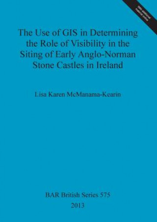
Kód: 02759300
Use of GIS in Determining the Role of Visibility in the Siting of Early Anglo-Norman Stone Castles in Ireland
Autor Lisa McManama-Kearin
This work examines the effectiveness of the use of GIS and GIS viewsheds as tools in the study of medieval castles in Ireland. To date, archaeological usage of GIS viewsheds has centred on prehistoric funerary sites. Little work h ... celý popis
- Jazyk:
 Angličtina
 - Vazba: Brožovaná
- Počet stran: 195
Nakladatelství: BAR Publishing, 2013
- Více informací o knize

Mohlo by se vám také líbit
-

This Giddy Globe
658 Kč -

Photophysical and Photochemical Tools in Polymer Science
2259 Kč -

Proceedings of First USA-USSR symposium on Fracture of Composite Materials
2259 Kč -

THz and Security Applications
5060 Kč -

Middle Income Access to Justice
1317 Kč -

Traite De Geometrie Analytique A L'Usage Des Candidats Aux Ecoles Du Gouvernement Et Aux Grades Universitaires, Par M. H. Picquet.
1152 Kč -

Fiscal Monitor, November 2010
1275 Kč -

Jesse Tree
267 Kč -

Josis Geschichten
414 Kč -

Vzali sme sa
147 Kč -

Geschichte der deutschen Kaiserzeit.
9136 Kč -

Ausbreitung Und Registrierung Ultrasonorer Schallwellen in Ozeanischen Seeraumen
1813 Kč -

Schlusselerlebnis
631 Kč -

Deine bunte Erde, Erlebniskarte mit Metallbeleistung
429 Kč
Darujte tuto knihu ještě dnes
- Objednejte knihu a zvolte Zaslat jako dárek.
- Obratem obdržíte darovací poukaz na knihu, který můžete ihned předat obdarovanému.
- Knihu zašleme na adresu obdarovaného, o nic se nestaráte.
Více informací o knize Use of GIS in Determining the Role of Visibility in the Siting of Early Anglo-Norman Stone Castles in Ireland
Nákupem získáte 232 bodů
 Anotace knihy
This work examines the effectiveness of the use of GIS and GIS viewsheds as tools in the study of medieval castles in Ireland. To date, archaeological usage of GIS viewsheds has centred on prehistoric funerary sites. Little work has been done using GIS
 Parametry knihy
Zařazení knihy Knihy v angličtině Earth sciences, geography, environment, planning Geography Cartography, map-making & projections
2320 Kč
- Plný název: Use of GIS in Determining the Role of Visibility in the Siting of Early Anglo-Norman Stone Castles in Ireland
- Autor: Lisa McManama-Kearin
- Jazyk:
 Angličtina
 - Vazba: Brožovaná
- Počet stran: 195
- EAN: 9781407310749
- ISBN: 1407310747
- ID: 02759300
- Nakladatelství: BAR Publishing
- Hmotnost: 784 g
- Rozměry: 297 × 210 × 13 mm
- Datum vydání: 15. January 2013
Oblíbené z jiného soudku
-

World of Gerard Mercator
285 Kč -

How to Lie with Maps, Third Edition
696 Kč -

Sky Atlas
678 Kč -

Minard System
1432 Kč -

Glasgow: Mapping the City
898 Kč -

How to Draw a Map
524 Kč -

Landmarks in Mapping
5755 Kč -
GIS
1961 Kč -
Art and Optics in the Hereford Map
1843 Kč -

Sad Topographies
995 Kč -

Cartographer's Toolkit
1732 Kč -

Mapping Antarctica
1657 Kč -

Handbook of Cartography
3507 Kč -

Map Addict
336 Kč -

Under the Map of Germany
2078 Kč -

Map Functions
4785 Kč -

Mapping New York
704 Kč -

Renaissance Galway
473 Kč -

Handbook of Research on Geospatial Science and Technologies
10635 Kč -
Mapping New Jersey
1208 Kč -

Manchester: Mapping the City
1004 Kč -

Mapping Latin America
1670 Kč -

Service-Oriented Mapping
5355 Kč -

Decolonizing the Map
2014 Kč -

Cartographic Turn - Mapping and the Spatial Challenge in Social Sciences
2561 Kč -

History of Cartography
8664 Kč -

Gijsbert Franco Baron Von Derfelden Van Hinderstein, 1783-1857
8169 Kč -

Computer Applications in Geography
5903 Kč -

Advances in Cartography and GIScience. Volume 2
5976 Kč -

Mapper of Mountains
1195 Kč -
Datums and Map Projections
1657 Kč -

Mapping
1277 Kč -

Cartographic Science
5181 Kč -

Essays on the Sociology of Perception
1724 Kč -

Commerce of Cartography
1587 Kč -

History of Cartography, Volume 1
12262 Kč -

Routledge Handbook of Mapping and Cartography
10453 Kč -

GIS and Cartographic Modeling
1710 Kč -

Mapping It Out
764 Kč -

Multimedia Cartography
6536 Kč -

Mapping Upper Canada, 1780-1867
6845 Kč -
Karte der Gasnetzbetreiber 2023
7397 Kč -

Die Erdteile in der Weltordnung des Mittelalters
5389 Kč -
Datums and Map Projections
4266 Kč -

Map Projections
5183 Kč -

London
1536 Kč -

Cartophilia
1433 Kč -

Archaeology and Geoinformatics
1210 Kč -

Cartography from Pole to Pole
5060 Kč
Osobní odběr Praha, Brno a 12903 dalších
Copyright ©2008-24 nejlevnejsi-knihy.cz Všechna práva vyhrazenaSoukromíCookies


 Vrácení do měsíce
 571 999 099 (8-15.30h)