
Kód: 06815949
Spatial Modeling of Soil Salinity Using Remote Sensing, GIS, and Field Data
Autor Eldeiry Ahmed
The environmental damage that salinity can cause is massive. In its early stages, soil salinization reduces soil productivity, but in advanced stages, salinization kills all vegetation and transforms fertile and productive land to ... celý popis
- Jazyk:
 Angličtina
 - Vazba: Brožovaná
- Počet stran: 112
Nakladatelství: VDM Verlag Dr. Mueller E.K., 2008
- Více informací o knize

Mohlo by se vám také líbit
Darujte tuto knihu ještě dnes
- Objednejte knihu a zvolte Zaslat jako dárek.
- Obratem obdržíte darovací poukaz na knihu, který můžete ihned předat obdarovanému.
- Knihu zašleme na adresu obdarovaného, o nic se nestaráte.
Více informací o knize Spatial Modeling of Soil Salinity Using Remote Sensing, GIS, and Field Data
Nákupem získáte 151 bodů
 Anotace knihy
The environmental damage that salinity can cause is massive. In its early stages, soil salinization reduces soil productivity, but in advanced stages, salinization kills all vegetation and transforms fertile and productive land to barren waste. Remote sensing data has great potential for monitoring dynamic processes, including salinization. Any integration of field data, GIS, and remote sensing is considered weak unless some strong statistical measures are introduced. This study has shown the benefit of using satellite images in generating accurate soil salinity maps. Corn and alfalfa crops were selected as indicators of soil salinity. Five images were acquired from Aster, Ikonos, and Landsat to check the correlation between measured soil salinity and remote sensing data. Observed data was used in conjunction with satellite images. Three models were applied to predict soil salinity from remote sensing: the ordinary least squares model (OLS), spatial autoregressive model (SAR), and modified kriging model. This study has demonstrated a more efficient and accurate way of estimating soil salinity from remote sensing data that should help the efforts toward sustainable agriculture.
 Parametry knihy
Zařazení knihy Knihy v angličtině Earth sciences, geography, environment, planning Geography
1506 Kč
- Plný název: Spatial Modeling of Soil Salinity Using Remote Sensing, GIS, and Field Data
- Autor: Eldeiry Ahmed
- Jazyk:
 Angličtina
 - Vazba: Brožovaná
- Počet stran: 112
- EAN: 9783639065978
- ISBN: 3639065972
- ID: 06815949
- Nakladatelství: VDM Verlag Dr. Mueller E.K.
- Hmotnost: 159 g
- Rozměry: 229 × 152 × 6 mm
- Datum vydání: 04. August 2008
Oblíbené z jiného soudku
-

Oxford IB Diploma Programme: Geography Course Companion
1555 Kč -

Geography: An Integrated Approach
2375 Kč -

Birds of New Guinea
1215 Kč -

IB Geography Study Guide: Oxford IB Diploma Programme
1255 Kč -

Birds of Hawaii and Micronesia
693 Kč -

Garibaldi
1742 Kč -

Level Geography Fieldwork & Skills
1657 Kč -

DANUBE BIKE TRAIL 1 DONAUESCHINGEN TO PA
386 Kč -

Incredible History of India'a Geography
255 Kč -

IB Geography Course Book: Oxford IB Diploma Programme
1211 Kč -

Cambridge International AS & A Level Geography Student's Book
1263 Kč -

Justinianic Mosaics of Hagia Sophia and Their Aftermath
2700 Kč -

comfort! map USA
358 Kč -
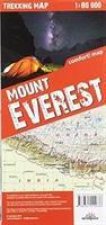
terraQuest Trekking Map Mount Everest
301 Kč -

Cambridge International AS and A Level Geography second edition
2255 Kč -
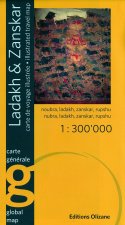
LADAKH ZANSKAR OLIZANE RV WP
698 Kč -

Do Earth
276 Kč -

Geography
1749 Kč -

Essential Maths Skills for AS/A-level Geography
408 Kč -

Dictionary of Physical Geography, 4e
1499 Kč -

Economic Geography - A Contemporary Introduction 3e
1226 Kč -

West Midlands A-Z Street Atlas (spiral)
488 Kč -

Butterflies of Europe
834 Kč -

History of the Adriatic: A Sea and Its Civilizatio n Cloth
677 Kč -

Cambridge International AS and A Level Geography Skills Workbook
591 Kč -

Urban Planning Imagination - A Critical International Introduction
620 Kč -

Geology of Egypt
814 Kč -
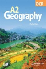
OCR A2 Geography Textbook
223 Kč -

Biogeography and biomorphology
677 Kč -

Porto - Michelin City Plan 85
188 Kč -

Once Within Borders
755 Kč -

New Literary History of Modern China
1267 Kč -

Geography for Cambridge International AS and A Level Revision Guide
938 Kč -

Birds of Prey of the East
550 Kč -

Road Map Normandy
358 Kč -

Birds of Prey of the West
675 Kč -

IB Diploma
1035 Kč -

Saint Kitts / Nevis
484 Kč -

Publics and the City
1336 Kč -

Havana / Cuba Central
291 Kč -

Planetary Social Thought
778 Kč -
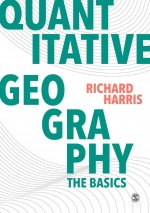
Quantitative Geography
1283 Kč -

Edexcel GCE Geography Y2 A Level Student Book and eBook
1203 Kč -

comfort! map Sweden
373 Kč -

Walter Benjamin
888 Kč -

Historical Population Atlas of the Czech Lands
846 Kč -
Historical and Topographical Guide to the Geography of Strabo
7046 Kč -

CAMINO SANTIAGO 2326 GPS RABANALTRIACAST
174 Kč -

Introduction to Sociological Theory - Theorists, Concepts, and their Applicability to the Twenty- First Century
1351 Kč
Osobní odběr Praha, Brno a 12903 dalších
Copyright ©2008-24 nejlevnejsi-knihy.cz Všechna práva vyhrazenaSoukromíCookies


 Vrácení do měsíce
 571 999 099 (8-15.30h)