Kód: 01560275
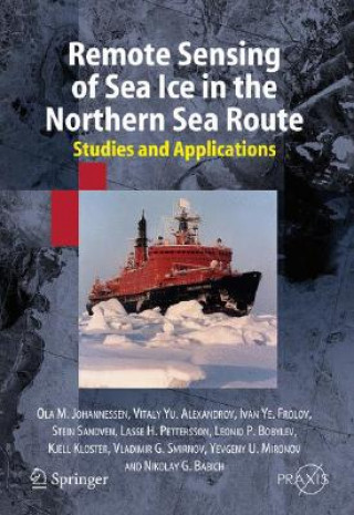
Remote Sensing of Sea Ice in the Northern Sea Route
Autor Ola M. Johannessen, V. Alexandrov, L. P. Bobylev
Remote Sensing of Sea Ice in the Northern Sea Route: Studies and Applications initially provides a history of the Northern Sea Route as an important strategic transport route for supporting the northern regions of Russia and cargo ... celý popis
- Jazyk:
 Angličtina
 - Vazba: Pevná
- Počet stran: 472
Nakladatelství: Springer-Verlag Berlin and Heidelberg GmbH & Co. KG, 2005
- Více informací o knize

Mohlo by se vám také líbit
-

Peggy Guggenheim
408 Kč -

Pettyfoggers and Vipers of the Commonwealth
1174 Kč -

Cambridge Companion to Aristotle's Nicomachean Ethics
907 Kč -

Jeffersonian America
1925 Kč -

Wolf Hall and Bring Up the Bodies
1317 Kč -

Crimestopper
373 Kč -

Padiatrische Neuroradiologie
5094 Kč -

El Iluminante Mundo de La Luz Con Max Axiom, Supercientifico
1330 Kč -

Warum keiner will, dass du nach oben kommst ...
498 Kč -

Neurológia
201 Kč -

John Stuart Mill zur Einführung
405 Kč -

Naturgesetz
554 Kč -

Wirkungen Eines Weissen Mantels / Der Arme Wohltater / Der Pfortner Im Herrenhause
259 Kč -

Anziehungskraft
177 Kč -

House of Night - Bestimmt
432 Kč -

Die Auswirkungen irreführender Werbung auf einen schuldrechtlichen Folgevertrag
960 Kč -

Liquidity at Risk - Eine Methodik zur Ermittlung des Liquiditatsrisikos in Banken
1022 Kč -

Entwicklungsperspektiven öffnen
607 Kč -

Handbuch öffentlicher Konzessionen
1987 Kč -

Radostné bezdomovectví krlíčka a jeho přátel
43 Kč -

Café Müller, m. DVD
995 Kč
Darujte tuto knihu ještě dnes
- Objednejte knihu a zvolte Zaslat jako dárek.
- Obratem obdržíte darovací poukaz na knihu, který můžete ihned předat obdarovanému.
- Knihu zašleme na adresu obdarovaného, o nic se nestaráte.
Více informací o knize Remote Sensing of Sea Ice in the Northern Sea Route
Nákupem získáte 896 bodů
 Anotace knihy
Remote Sensing of Sea Ice in the Northern Sea Route: Studies and Applications initially provides a history of the Northern Sea Route as an important strategic transport route for supporting the northern regions of Russia and cargo transportation between Europe and the Northern Pacific Basin. The authors then describe sea ice conditions in the Eurasian Arctic Seas and, using microwave satellite data, provide a detailed analysis of difficult sea ice conditions. Remote sensing techniques and the basic principles of SAR image formation are described, as well as the major satellite radar systems used for ice studies in the Arctic. The authors take a good look at the use of sensing equipment in experiments, including the ICE WATCH project used for monitoring the Northern Sea Route. The possibilities of using SAR remote sensing for ice navigation in the Northern Sea Route is also detailed, analysing techniques of automatic image processing and interpretation. A study is provided of regional drifting ice, fast ice and river ice in the coastal areas of the Arctic Seas. The book concludes with a review of the practical experience using SAR images for supporting navigation and offshore industrial activity, based on a series of experiments conducted with the Murmansk Shipping Company on board nuclear icebreakers. TOC:The Northern Sea Route.- Sea ice conditions in the Eurasian Arctic.- Sea Ice Remote Sensing Techniques.- SAR Remote Sensing Field campaigns in the Northern Sea Route.- SAR image interpretation and retrieval of sea ice parameters.- SAR studies in the Barents and Pechora seas.- SAR studies in the Kara Sea.- SAR studies in the Laptev Sea and in the eastern Eurasian Arctic.- Application of SAR data for supporting ice navigation.
 Parametry knihy
Zařazení knihy Knihy v angličtině Earth sciences, geography, environment, planning Earth sciences Geology & the lithosphere
8955 Kč
- Plný název: Remote Sensing of Sea Ice in the Northern Sea Route
- Podnázev: Studies and Applications
- Autor: Ola M. Johannessen, V. Alexandrov, L. P. Bobylev
- Jazyk:
 Angličtina
 - Vazba: Pevná
- Počet stran: 472
- EAN: 9783540244486
- ISBN: 3540244484
- ID: 01560275
- Nakladatelství: Springer-Verlag Berlin and Heidelberg GmbH & Co. KG
- Hmotnost: 1153 g
- Rozměry: 242 × 170 × 35 mm
- Datum vydání: 01. November 2005
Oblíbené z jiného soudku
-

Reading the Rocks
386 Kč -

Nature and Properties of Soils, The, Global Edition
2294 Kč -

Past Time: Geology in European and American Art
1064 Kč -

S & S Guide to Rocks and Minerals
582 Kč -

Structural Geology
1764 Kč -

Sea without Fish
983 Kč -

Geological Field Techniques
1900 Kč -

Soil Science Simplified 6e
2658 Kč -

Lost World of Fossil Lake
967 Kč -

Pleistocene Boundary and the Beginning of the Quaternary
2454 Kč -
Stable Isotope Geochemistry
2720 Kč -

H2O
303 Kč -

Mycorrhizal Planet
811 Kč -

Story of Earth
347 Kč -

Geology For Dummies
483 Kč -

True Truffle (Tuber spp.) in the World
7468 Kč -

Annals of the Former World
598 Kč -

Environmental Chemistry
3747 Kč -
Radon: A Tracer for Geological, Geophysical and Geochemical Studies
7468 Kč -
The Geology of Kuwait
1189 Kč -

Medical Geology
2036 Kč -

Anthropocene: A Very Short Introduction
250 Kč -

Ice Age
1967 Kč -

Brief History of Geology
848 Kč -

Rocks: A Very Short Introduction
276 Kč -
Glaciation: A Very Short Introduction
250 Kč -
Geology: A Very Short Introduction
250 Kč -

Making of Europe
904 Kč -

Mineral Resources, Economics and the Environment
1949 Kč -

Timefulness
1013 Kč -

Historical Geology
2137 Kč -
Global Geomorphology
2170 Kč -
Principles of Geology, Volume 1
802 Kč -

Plate Tectonics: A Very Short Introduction
282 Kč -

Igneous and Metamorphic Petrology 2e
3610 Kč -

Landscapes and Geomorphology: A Very Short Introduction
273 Kč -

Ore Deposit Geology
1926 Kč -

Soil and Environmental Chemistry
3073 Kč -
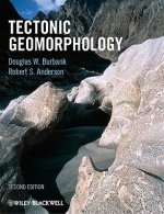
Tectonic Geomorphology 2e
2916 Kč -
Fossils: A Very Short Introduction
272 Kč -

Earth on Show
1621 Kč -

Quaternary Paleoenvironments - Submerged Landscapes of the European Continental Shelf.
3338 Kč -

Last Giant of Beringia
683 Kč -
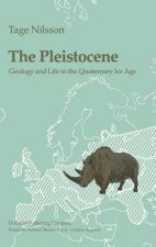
Pleistocene
6578 Kč -
Earth: An Introduction to Physical Geology, Global Edition
2210 Kč -

White River Badlands
1081 Kč -

Principles of Geology, Volume 2
1874 Kč -

Principles of Geology, Volume 3
1831 Kč -
Geomorphology
2690 Kč
Osobní odběr Praha, Brno a 12903 dalších
Copyright ©2008-24 nejlevnejsi-knihy.cz Všechna práva vyhrazenaSoukromíCookies


 Vrácení do měsíce
 571 999 099 (8-15.30h)