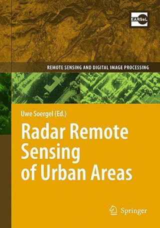
Kód: 04372406
Radar Remote Sensing of Urban Areas
Autor Uwe Soergel
This book presents a unique collection of state-of-the-art contributions by international remote sensing experts focussing on methodologies to extract information about urban areas from Synthetic Aperture Radar (SAR) data. SAR is ... celý popis
- Jazyk:
 Angličtina
 - Vazba: Pevná
- Počet stran: 278
Nakladatelství: Springer, 2010
- Více informací o knize

3313 Kč

Skladem u dodavatele v malém množství
Odesíláme za 12-15 dnů
Potřebujete více kusů?Máte-li zájem o více kusů, prověřte, prosím, nejprve dostupnost titulu na naši zákaznické podpoře.
Přidat mezi přání
Mohlo by se vám také líbit
-

ReWork
378 Kč -

Adventures of Huckleberry Finn
193 Kč -

Central Philosophy of Tibet
2135 Kč -

Complete Poems of T. H. Jones, 1921-1965
1736 Kč -

Global Prescriptions
3711 Kč -

Country of Cities
704 Kč -

Accent On Achievement, Querflöte. Bk.1
301 Kč
Darujte tuto knihu ještě dnes
- Objednejte knihu a zvolte Zaslat jako dárek.
- Obratem obdržíte darovací poukaz na knihu, který můžete ihned předat obdarovanému.
- Knihu zašleme na adresu obdarovaného, o nic se nestaráte.
Více informací o knize Radar Remote Sensing of Urban Areas
Nákupem získáte 331 bodů
 Anotace knihy
This book presents a unique collection of state-of-the-art contributions by international remote sensing experts focussing on methodologies to extract information about urban areas from Synthetic Aperture Radar (SAR) data. SAR is an active remote sensing technique capable to gather data independently from sun light and weather conditions. Emphasizing technical and geometrical issues the potential and limits of SAR are addressed in focussed case studies, for example, the detection of buildings and roads, traffic monitoring, surface deformation monitoring, and urban change. These studies can be sorted into two groups: the mapping of the current urban state and the monitoring of change. The former covers, for instance, methodologies for the detection and reconstruction of individual buildings and road networks; the latter, for example, surface deformation monitoring and urban change. This includes also investigations related to the benefit of SAR Interferometry, which is useful to determine either digital elevation models and surface deformation or the radial velocity of objects (e.g. cars), and the Polarization of the signal that comprises valuable information about the type of soil and object geometry. Furthermore, the features of modern satellite and airborne sensor devices which provide high-spatial resolution of the urban scene are discussed.
 Parametry knihy
Zařazení knihy Knihy v angličtině Earth sciences, geography, environment, planning Geography Geographical information systems (GIS) & remote sensing
3313 Kč
- Plný název: Radar Remote Sensing of Urban Areas
- Autor: Uwe Soergel
- Jazyk:
 Angličtina
 - Vazba: Pevná
- Počet stran: 278
- EAN: 9789048137503
- ISBN: 9048137500
- ID: 04372406
- Nakladatelství: Springer
- Hmotnost: 666 g
- Rozměry: 235 × 155 × 23 mm
- Datum vydání: 18. March 2010
Oblíbené z jiného soudku
-

Designing Better Maps
1489 Kč -

Cartography.
1647 Kč -

Mastering Geospatial Analysis with Python
1533 Kč -

Semiology of Graphics
3423 Kč -

Geographic Information Science and Systems 4e
5563 Kč -
GIS for Science
1273 Kč -

Geocaching
481 Kč -

Introduction to Geographical Information Systems, An
2010 Kč -

Connections and Content
1358 Kč -

Focus on Geodatabases in ArcGIS Pro
1711 Kč -

Framework for Geodesign
2271 Kč -
Esri Guide to GIS Analysis, Volume 3
1291 Kč -

Springer Handbook of Geographic Information
10603 Kč -

Reconstruction and Analysis of 3D Scenes
5083 Kč -

Geoinformatics
908 Kč -

Mastering ArcGIS Server Development with JavaScript
1370 Kč -

LiDAR Remote Sensing and Applications
3344 Kč -

GIS For Dummies
988 Kč -

ArcGIS Book
593 Kč -

Python For ArcGIS
3611 Kč -

Spring Boot Messaging
1384 Kč -

GNSS - Global Navigation Satellite Systems
5355 Kč -

GIS in Land and Property Management
6904 Kč -

Spatial Statistics and Geostatistics
2086 Kč -

Programming GPS and OpenStreetMap Applications with Java
2310 Kč -

European Landscape Dynamics
6712 Kč -

Introduction to GIS Programming and Fundamentals with Python and ArcGIS (R)
3584 Kč -

Satellite Interferometry Data Interpretation and Exploitation
4814 Kč -
Error Propagation in Environmental Modelling with GIS
3880 Kč -

QGIS Python Programming Cookbook -
1532 Kč -

Learning ArcGIS Pro
1532 Kč -

GPS For Dummies 2e
662 Kč -

Mastering QGIS -
1695 Kč -

Introducing Geographic Information Systems with ArcGIS - A Workbook Approach to Learning GIS, Third Edition
3284 Kč -
Integration of GIS and Remote Sensing
6745 Kč -

Energy of Nations
1310 Kč -

Physical Principles of Remote Sensing
4858 Kč -

New Developments and Environmental Applications of Drones
5391 Kč -

Mapping with ArcGIS Pro
1370 Kč -

GIS and Spatial Analysis for the Social Sciences
3190 Kč -

Satellite Altimetry Over Oceans and Land Surfaces
6904 Kč -

Learning QGIS 2.0
772 Kč -

ArcGIS Pro and ArcGIS Online Applications in Water and Environmental Sciences
2260 Kč -

Open Source GIS
5094 Kč -

Recent Advances in Remote Sensing for Crop Growth Monitoring
2666 Kč -

Artificial Intelligence in Geography
8972 Kč -

Geolocation in iOS
607 Kč -
Remote Sensing Data Book
3483 Kč -
Geographic Information Systems (GIS)
8779 Kč
Osobní odběr Praha, Brno a 12903 dalších
Copyright ©2008-24 nejlevnejsi-knihy.cz Všechna práva vyhrazenaSoukromíCookies


 Vrácení do měsíce
 571 999 099 (8-15.30h)