Kód: 52481849
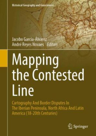
Mapping the Contested Line
Autor Jacobo García-Álvarez, André Reyes Novaes
This book brings together eight contributions on the relationships between cartography and border disputes, using map history to frame the construction of nation-states and colonial territories in the Iberian Peninsula, North Afri ... celý popis


- Jazyk:
 Angličtina
 - Vazba: Pevná
- Počet stran: 173
Nakladatelství: Springer, Berlin, 2026
- Více informací o knize


Mohlo by se vám také líbit
-

Moonwalk
270 Kč -

The Score
248 Kč -

The Deal
242 Kč -

The Mistake
227 Kč -

Berserk Deluxe Volume 1
779 Kč -

Jujutsu Kaisen, Vol. 30
199 Kč -

Berserk Deluxe Volume 2
862 Kč -

Dancing The Dream
517 Kč -

The Goal
261 Kč -

Berserk Deluxe Volume 3
804 Kč -

Murdoku
319 Kč -

White Nights
83 Kč -

Chainsaw Man, Vol. 21
240 Kč -
Invincible Compendium Volume 2
1108 Kč -

The Legacy
244 Kč -

Lord of Mysteries, Vol. 3: The Clown, Part III
373 Kč -

Jujutsu Kaisen, Vol. 29
240 Kč -

Invincible Compendium Volume 3
1123 Kč -

JoJo's Bizarre Adventure: Part 7--Steel Ball Run, Vol. 7
427 Kč -

Witch Hat Atelier: Grimoire Edition 1
786 Kč -

Berserk Deluxe Volume 5
804 Kč
Darujte tuto knihu ještě dnes
- Objednejte knihu a zvolte Zaslat jako dárek.
- Obratem obdržíte darovací poukaz na knihu, který můžete ihned předat obdarovanému.
- Knihu zašleme na adresu obdarovaného, o nic se nestaráte.
Informovat o naskladnění knihy
Zadejte do formuláře e-mailovou adresu a jakmile knihu naskladníme, zašleme vám o tom zprávu. Pohlídáme vše za vás.
Více informací o knize Mapping the Contested Line
Nákupem získáte 387 bodů
 Anotace knihy
This book brings together eight contributions on the relationships between cartography and border disputes, using map history to frame the construction of nation-states and colonial territories in the Iberian Peninsula, North Africa and Latin America from the 18th to the 20th century. Written by scholars from Spain, France, Portugal, Argentina, Uruguay and Brazil, the essay is divided into two main parts. Part I (Chapters 2 to 5) focuses on the use and contribution of maps to the processes of negotiation and boundary fixation on disputed borders, both in diplomatic forums and in the materialisation of the border on the ground, whereas Part II (Chapters 6 to 8) delves into the circulation of maps used by boundary commissions, as well as into how the political purposes of cartography and the audiences to whom maps were addressed and communicated conditioned the very representation of borders. In addition to these Parts, the introductory chapter provides an overview of recent scholarship about the links between maps and border disputes, both at a general level and in the countries and regions specifically considered in this volume. The book is addressed to a wide range of researchers, including geographers, historians, political scientists and specialists in geopolitics and the history of international relations.
Parametry knihy
3871 Kč
- Plný název: Mapping the Contested Line
- Podnázev: Cartography And Border Disputes In The Iberian Peninsula, North Africa And Latin America (18-20th Centuries).DE
- Autor: Jacobo García-Álvarez, André Reyes Novaes
- Edice: Historical Geography and Geosciences,
- Jazyk: Angličtina
- Vazba: Pevná
- Počet stran: 173
- EAN: 9783032298881
- ID: 52481849
- Nakladatelství: Springer, Berlin
- Rozměry: 254 × 178 mm
- Datum vydání: 14. August 2026
Osobní odběr Praha, Brno a 46788 dalších
Copyright ©2008-26 nejlevnejsi-knihy.cz Všechna práva vyhrazenaSoukromíCookies

 Vrácení do měsíce
 571 999 099 (8-15.30h)