
Kód: 01658477
Inland Water Altimetry
Autor Jérôme Benveniste, Stefano Vignudelli, Andrey G. Kostianoy
This book will bring an integrated view of the state-of-the art in the matter to the water scientists eager to add Radar Altimetry to their toolkit. It describes experience in application of satellite altimetry to the different in ... celý popis
- Jazyk:
 Angličtina
 - Vazba: Pevná
- Počet stran: 500
Nakladatelství: Springer-Verlag Berlin and Heidelberg GmbH & Co. KG, 2023
- Více informací o knize

Mohlo by se vám také líbit
-

Czerny - 40 Daily Exercises, Op. 337: Schirmer Library of Classics Volume 149 Piano Technique
265 Kč -

Jane of Lantern Hill
223 Kč -

Routledge Library Editions: Communication Studies
41768 Kč -

One Piece: Ace's Story, Vol. 1
223 Kč -

The Bach Cello Suites
366 Kč -

Collided Special Edition
503 Kč -

Elden Ring: The Road to the Erdtree
336 Kč
Darujte tuto knihu ještě dnes
- Objednejte knihu a zvolte Zaslat jako dárek.
- Obratem obdržíte darovací poukaz na knihu, který můžete ihned předat obdarovanému.
- Knihu zašleme na adresu obdarovaného, o nic se nestaráte.
Informovat o naskladnění knihy
Zadejte do formuláře e-mailovou adresu a jakmile knihu naskladníme, zašleme vám o tom zprávu. Pohlídáme vše za vás.
Více informací o knize Inland Water Altimetry
Nákupem získáte 479 bodů
 Anotace knihy
This book will bring an integrated view of the state-of-the art in the matter to the water scientists eager to add Radar Altimetry to their toolkit. It describes experience in application of satellite altimetry to the different inland seas, lakes and rivers in the World. It presents the principal problems related to the altimetry derived products in inland seas, lakes and rivers and ways of their improvement. This publication is based on numerous satellite and observational data collected and analyzed by the authors of the various chapters in the framework of a set of international projects, performed in Europe, Russia, USA, and China. The book will contribute both to the ongoing International Altimeter Service effort and to the building of a sustained Continental Water observing system in the perspective of GMES and GEOSS initiatives, supplied with satellite data from the series of Sentinel-3 satellites, the Jason series and further on the revolutionary SWOT Satellite Mission. This book is aimed at specialists concerned with research in the various fields of satellite altimetry and remote sensing of Continental Waters. The book will also be interesting for lecturers, students and post-graduate students. Pratical applications stemming from the book content will be supported by, and can be advertised through, the ESA-CNES Basic Radar Altimetry Toolbox and its Radar Altimetry Tutorial ( )
 Parametry knihy
Zařazení knihy Knihy v angličtině Earth sciences, geography, environment, planning Earth sciences Hydrology & the hydrosphere
4790 Kč
- Plný název: Inland Water Altimetry
- Autor: Jérôme Benveniste, Stefano Vignudelli, Andrey G. Kostianoy
- Jazyk:
 Angličtina
 - Vazba: Pevná
- Počet stran: 500
- EAN: 9783642226786
- ISBN: 3642226787
- ID: 01658477
- Nakladatelství: Springer-Verlag Berlin and Heidelberg GmbH & Co. KG
- Rozměry: 235 × 155 mm
- Datum vydání: 11. June 2023
Oblíbené z jiného soudku
-

Oceanology
1102 Kč -

Oceans of Kansas, Second Edition
1009 Kč -

Ocean Animals Sticker Activity Book
155 Kč -

Attacking Ocean
675 Kč -

Hydrological Drought
5405 Kč -

Lakes: A Very Short Introduction
282 Kč -

Under the Sea-Wind
378 Kč -

Rainfall-Runoff Modelling - The Primer 2e
2774 Kč -

Oceans: A Very Short Introduction
282 Kč -

World Is Blue
384 Kč -

Middle Sea
410 Kč -

Water Wizard
704 Kč -

Log from the Sea of Cortez
464 Kč -

Groundwater Hydrology
2403 Kč -

Our Changing Planet
1437 Kč -

Industrial Wastewater Treatment
5094 Kč -

Oceans
771 Kč -

Alien Ocean
1031 Kč -
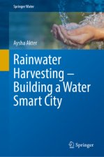
Rainwater Harvesting-Building a Water Smart City
4798 Kč -

Ocean Worlds
357 Kč -

Essentials of Oceanography
3056 Kč -

Atlantic
410 Kč -
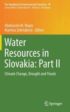
Water Resources in Slovakia: Part II
8953 Kč -

Atchafalaya River Basin
989 Kč -

Principles of Snow Hydrology
1737 Kč -

Water
516 Kč -

Applied Hydrogeology
2479 Kč -

Advanced Dam Engineering for Design, Construction, and Rehabilitation
6578 Kč -

Fluvial Processes in Geomorphology: Seco
847 Kč -

Geology for Geotechnical Engineers
1315 Kč -

Gravel-Bed Rivers - Processes and Disasters
6169 Kč -

Water Treatment for Purification from Cyanobacteria and Cyanotoxins
4917 Kč -

Tracers in Hydrology
3213 Kč -

Tsunamis
283 Kč -

Ocean Surface Waves: Their Physics And Prediction (2nd Edition)
2741 Kč -

Mapping the Deep
641 Kč -

Encyclopedia of Water
36366 Kč -

Rivers: A Very Short Introduction
283 Kč -

Introduction to Physical Oceanography
3611 Kč -

Sea is Not Made of Water
475 Kč -

Design of Hydraulic Gates
9582 Kč -

Sea Ice Biota
7095 Kč -

Book of Tides
766 Kč -

Advanced Treatment Technologies for Fluoride Removal in Water
4798 Kč -

Essentials of Oceanography
5049 Kč -

The Danube River Delta
3313 Kč -

Offshore Structures
3017 Kč -

Satellite Sar Detection Of Sub-mesoscale Ocean Dynamic Processes
4274 Kč -

Limnology and Freshwater Ecology
3779 Kč
Osobní odběr Praha, Brno a 12903 dalších
Copyright ©2008-24 nejlevnejsi-knihy.cz Všechna práva vyhrazenaSoukromíCookies


 Vrácení do měsíce
 571 999 099 (8-15.30h)