Kód: 05273990
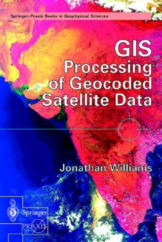
GIS Processing of Geocoded Satellite Data
Autor Jonathan Williams
The book opens with the basic techniques of satellite geocoding (including the use of GPS and mosaic production) before describing a wide range of algorithms for extraction of information from optical and radar satellite images. T ... celý popis
- Jazyk:
 Angličtina
 - Vazba: Pevná
- Počet stran: 327
Nakladatelství: Springer-Verlag Berlin and Heidelberg GmbH & Co. KG, 2001
- Více informací o knize

5094 Kč

Skladem u dodavatele v malém množství
Odesíláme za 12-15 dnů
Potřebujete více kusů?Máte-li zájem o více kusů, prověřte, prosím, nejprve dostupnost titulu na naši zákaznické podpoře.
Přidat mezi přání
Mohlo by se vám také líbit
-

Library and Information Sciences
1830 Kč -

Himalayan Plants
6805 Kč -

Technical Handbook for Satellite Monitoring
1985 Kč -

Good Earth
312 Kč -

Guide to the Town and Neighbourhood of Abergavenny.
588 Kč -

Glonacal Contexts
2405 Kč -

Going Forward on Your Knees
455 Kč -

Shredding the Public Interest
291 Kč -

In Love and War
767 Kč -

Critical Small Schools
1792 Kč -

World is Our Cloister
606 Kč -
Remote Sensing Data Book
3749 Kč -

Birds of East Africa
1146 Kč -

Pitcairn Island
3936 Kč -

From Nature to Experience
2624 Kč -

Radiation
494 Kč -

Ulysses, 4 Audio-CD, 4 MP3
1580 Kč -

Waldszenen
405 Kč -

ABC der Tiere - Lieder und Kontrastpaare, Audio-CD, Audio-CD + Der Film, DVD
750 Kč -

Loriots Kleiner Opernführer
389 Kč -

Grand Livre Des Patissiers Et Des Confiseurs. T. 2 (Ed.1883)
793 Kč
Darujte tuto knihu ještě dnes
- Objednejte knihu a zvolte Zaslat jako dárek.
- Obratem obdržíte darovací poukaz na knihu, který můžete ihned předat obdarovanému.
- Knihu zašleme na adresu obdarovaného, o nic se nestaráte.
Více informací o knize GIS Processing of Geocoded Satellite Data
Nákupem získáte 509 bodů
 Anotace knihy
The book opens with the basic techniques of satellite geocoding (including the use of GPS and mosaic production) before describing a wide range of algorithms for extraction of information from optical and radar satellite images. The text then moves on to address the derivation of topographic information from space (including the recent Shuttle Topographic Radar Mission) followed by an explanation of the added-value obtained through the integrated use of geocoded satellite data in a Geographic Information System (GIS). Practical commercial and scientific applications are described in detail - first looking at land applications such as agriculture and civil engineering and then at the oceanographic, atmospheric and cryospheric worlds. Jonathan Williams reviews recent developments in 'environmental monitoring and global security' such as hazard and disaster monitoring, population dynamics and space missions dedicated to environmental monitoring (such as the Earth Observing System and the European ENVISAT Mission). Finally, the author draws together all the threads under the generic term of geomatics - addressing cutting-edge developments such as Very High Resolution Imagery (VHR) and the role that satellite data may play in the development of Location Based Services for the third-generation telecom market.
 Parametry knihy
Zařazení knihy Knihy v angličtině Earth sciences, geography, environment, planning Geography Geographical information systems (GIS) & remote sensing
5094 Kč
- Plný název: GIS Processing of Geocoded Satellite Data
- Autor: Jonathan Williams
- Jazyk:
 Angličtina
 - Vazba: Pevná
- Počet stran: 327
- EAN: 9783540426486
- ISBN: 3540426485
- ID: 05273990
- Nakladatelství: Springer-Verlag Berlin and Heidelberg GmbH & Co. KG
- Hmotnost: 900 g
- Rozměry: 235 × 155 × 26 mm
- Datum vydání: 01. October 2001
Oblíbené z jiného soudku
-

Designing Better Maps
1643 Kč -

Cartography.
1648 Kč -

Mastering Geospatial Analysis with Python
1564 Kč -

Semiology of Graphics
3423 Kč -

Geographic Information Science and Systems 4e
5566 Kč -

GIS for Science
1248 Kč -

Geocaching
479 Kč -

Introduction to Geographical Information Systems, An
2042 Kč -

Connections and Content
1284 Kč -

Focus on Geodatabases in ArcGIS Pro
1914 Kč -

Framework for Geodesign
2462 Kč -

Esri Guide to GIS Analysis, Volume 3
1447 Kč -

Springer Handbook of Geographic Information
10603 Kč -

Reconstruction and Analysis of 3D Scenes
4859 Kč -

Geoinformatics
926 Kč -

Mastering ArcGIS Server Development with JavaScript
1398 Kč -

LiDAR Remote Sensing and Applications
3343 Kč -

GIS For Dummies
992 Kč -

ArcGIS Book
771 Kč -

Python For ArcGIS
3611 Kč -

Spring Boot Messaging
1384 Kč -

GNSS - Global Navigation Satellite Systems
5985 Kč -

GIS in Land and Property Management
7887 Kč -

Spatial Statistics and Geostatistics
2135 Kč -

Programming GPS and OpenStreetMap Applications with Java
2310 Kč -

European Landscape Dynamics
6712 Kč -

Satellite Interferometry Data Interpretation and Exploitation
4814 Kč -

Introduction to GIS Programming and Fundamentals with Python and ArcGIS (R)
3664 Kč -

Error Propagation in Environmental Modelling with GIS
3966 Kč -

QGIS Python Programming Cookbook -
1564 Kč -

Learning ArcGIS Pro
1564 Kč -

GPS For Dummies 2e
634 Kč -

Mastering QGIS -
1730 Kč -

Introducing Geographic Information Systems with ArcGIS - A Workbook Approach to Learning GIS, Third Edition
3284 Kč -

Integration of GIS and Remote Sensing
6884 Kč -

Energy of Nations
1339 Kč -

Physical Principles of Remote Sensing
5223 Kč -

New Developments and Environmental Applications of Drones
5391 Kč -

GIS and Spatial Analysis for the Social Sciences
3190 Kč -

Mapping with ArcGIS Pro
1398 Kč -

Satellite Altimetry Over Oceans and Land Surfaces
7284 Kč -

Learning QGIS 2.0
788 Kč -

Open Source GIS
5094 Kč -

ArcGIS Pro and ArcGIS Online Applications in Water and Environmental Sciences
2259 Kč -

Geographic Information Systems (GIS)
8779 Kč -

Geographical Information Science
2693 Kč -

Spatial Conservation Prioritization
6105 Kč -

Digital Terrain Modelling
5094 Kč -

Thermal Infrared Remote Sensing
5362 Kč
Osobní odběr Praha, Brno a 12903 dalších
Copyright ©2008-24 nejlevnejsi-knihy.cz Všechna práva vyhrazenaSoukromíCookies


 Vrácení do měsíce
 571 999 099 (8-15.30h)