Kód: 53268728
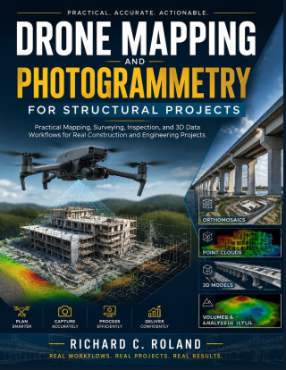
Drone Mapping and Photogrammetry for Structural Projects
Autor Richard C. Roland
How do drone images become accurate maps, 3D models, measurements, and professional inspection reports?Drone mapping is transforming the way construction, engineering, surveying, and inspection projects collect and use data. Howev ... celý popis


- Jazyk:
 Angličtina
 - Vazba: Brožovaná
- Počet stran: 198
Nakladatelství: Independently published, 2026
- Více informací o knize


Mohlo by se vám také líbit
-

Murdoku
319 Kč -

Threshing Day (Wing and Claw Collection)
400 Kč -

Berserk Deluxe Volume 1
860 Kč -

Threshing Day (Limited Deluxe Edition)
473 Kč -

Berserk Deluxe Volume 2
917 Kč -

White Nights
89 Kč -

The Odyssey
320 Kč -

Kid's Box New Generation Level 2 Activity Book with Digital Pack British English
288 Kč -

Berserk Deluxe Volume 3
779 Kč -

Moonwalk
231 Kč -

Onyx Storm (Deluxe Limited Edition) (The Empyrean, 3)
550 Kč -

Dancing The Dream
482 Kč -

Kid's Box New Generation Level 2 Pupil's Book with eBook British English
376 Kč -

The Score
232 Kč -

Murdoku Volume 2: Back in Time
319 Kč -

Jujutsu Kaisen, Vol. 26
225 Kč -

The Mistake
222 Kč -

Kid's Box New Generation Level 1 Activity Book with Digital Pack British English
288 Kč -

Kid's Box New Generation Level 3 Activity Book with Digital Pack British English
288 Kč -

Fourth Wing
525 Kč -

Lord of Mysteries, Vol. 1: The Clown, Part I
349 Kč
Darujte tuto knihu ještě dnes
- Objednejte knihu a zvolte Zaslat jako dárek.
- Obratem obdržíte darovací poukaz na knihu, který můžete ihned předat obdarovanému.
- Knihu zašleme na adresu obdarovaného, o nic se nestaráte.
Více informací o knize Drone Mapping and Photogrammetry for Structural Projects
Nákupem získáte 57 bodů
 Anotace knihy
How do drone images become accurate maps, 3D models, measurements, and professional inspection reports?
Drone mapping is transforming the way construction, engineering, surveying, and inspection projects collect and use data. However, getting valuable results requires more than simply flying a drone. You need to understand flight planning, image capture, photogrammetry, data processing, accuracy, and professional reporting.
Drone Mapping and Photogrammetry for Structural Projects is a practical guide that helps you understand the complete workflow behind modern drone-based projects. Whether you want to learn how to do drone mapping, explore drone photogrammetry, improve your drone survey training, or understand construction drone technology, this guide provides the knowledge needed to work with real project data.
Inside, you will learn how to:
• Plan drone missions for construction sites, structural inspections, and surveying projects.
• Understand cameras, sensors, RTK/PPK systems, and essential field equipment.
• Apply photogrammetry techniques to create orthomosaics, point clouds, and 3D models.
• Process drone data for GIS, CAD, BIM, and engineering workflows.
• Capture useful inspection data for buildings, bridges, roofs, and other structures.
• Create professional reports and deliverables for real clients.
Designed for beginners, drone operators, construction professionals, engineering students, and anyone interested in professional drone services, this guide helps you understand the skills, workflows, and practices behind successful drone mapping projects.
Start building your knowledge of drone surveying, photogrammetry, structural inspection, and 3D data workflows today.
Parametry knihy
565 Kč
- Plný název: Drone Mapping and Photogrammetry for Structural Projects
- Podnázev: Practical Mapping, Surveying, Inspection, and 3D Data Workflows for Real Construction and Engineering Projects.
- Autor: Richard C. Roland
- Jazyk: Angličtina
- Vazba: Brožovaná
- Počet stran: 198
- EAN: 9798187665365
- ID: 53268728
- Nakladatelství: Independently published
- Hmotnost: 473 g
- Rozměry: 280 × 216 × 11 mm
- Datum vydání: 17. July 2026
Osobní odběr Praha, Brno a 48595 dalších
Copyright ©2008-26 nejlevnejsi-knihy.cz Všechna práva vyhrazenaSoukromíCookies

 Vrácení do měsíce
 571 999 099 (8-15.30h)