Kód: 38885571
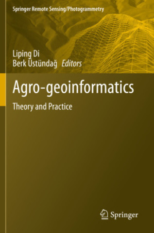
Agro-geoinformatics
Autor Liping Di, Berk Üstündag
This volume collects and presents the fundamentals, tools, and processes of utilizing geospatial information technologies to process remotely sensed data for use in agricultural monitoring and management. The issues related to han ... celý popis


- Jazyk:
 Angličtina
 - Vazba: Brožovaná
- Počet stran: 418
Nakladatelství: Springer Nature Switzerland AG, 2022
- Více informací o knize


Mohlo by se vám také líbit
-

Threshing Day (Limited Deluxe Edition)
488 Kč -

Murdoku
342 Kč -

The Long-Lived King: An Original The Owl House Graphic Novel
383 Kč -

The Mirror of Infinite Endings
333 Kč -

White Nights
89 Kč -

The Art of Gravity Falls
917 Kč -

Court of Thorns and Roses 6
358 Kč -

Berserk Deluxe Volume 1
900 Kč -

21 Days of Fear
406 Kč -

Lord of Mysteries, Vol. 4: The Faceless, Part I
358 Kč -

Jojo's Bizarre Adventure: Part 7--Steel Ball Run, Vol. 9
438 Kč -

The Mirror of Infinite Endings
531 Kč -

Trust Fall
228 Kč -

Berserk Deluxe Volume 3
823 Kč -

Protocols
334 Kč -

Berserk Deluxe Volume 2
965 Kč -

Witch Hat Atelier: Grimoire Edition 1
712 Kč -

Fourth Wing
563 Kč -

Penguin Readers Level 4: The Adventures of Sherlock Holmes (ELT Graded Reader)
178 Kč -

Iron Flame
563 Kč -

Witch Hat Atelier: Grimoire Edition 2
837 Kč
Darujte tuto knihu ještě dnes
- Objednejte knihu a zvolte Zaslat jako dárek.
- Obratem obdržíte darovací poukaz na knihu, který můžete ihned předat obdarovanému.
- Knihu zašleme na adresu obdarovaného, o nic se nestaráte.
Více informací o knize Agro-geoinformatics
Nákupem získáte 400 bodů
 Anotace knihy
This volume collects and presents the fundamentals, tools, and processes of utilizing geospatial information technologies to process remotely sensed data for use in agricultural monitoring and management. The issues related to handling digital agro-geoinformation, such as collecting (including field visits and remote sensing), processing, storing, archiving, preservation, retrieving, transmitting, accessing, visualization, analyzing, synthesizing, presenting, and disseminating agro-geoinformation have never before been systematically documented in one volume. The book is edited by International Conference on Agro-Geoinformatics organizers Dr. Liping Di (George Mason University), who coined the term "Agro-Geoinformatics" in 2012, and Dr. Berk Üstündag (Istanbul Technical University) and are uniquely positioned to curate and edit this foundational text.The book is composed of eighteen chapters that can each stand alone but also build on each other to give the reader a comprehensive understanding of agro-geoinformatics and what the tools and processes that compose the field can accomplish. Topics covered include land parcel identification, image processing in agricultural observation systems, databasing and managing agricultural data, crop status monitoring, moisture and evapotranspiration assessment, flood damage monitoring, agricultural decision support systems and more.
Parametry knihy
Zařazení knihy Knihy v angličtině Earth sciences, geography, environment, planning Geography Geographical information systems (GIS) & remote sensing
4000 Kč
- Plný název: Agro-geoinformatics
- Podnázev: Theory and Practice
- Autor: Liping Di, Berk Üstündag
- Jazyk: Angličtina
- Vazba: Brožovaná
- Počet stran: 418
- EAN: 9783030663896
- ID: 38885571
- Nakladatelství: Springer Nature Switzerland AG
- Hmotnost: 762 g
- Rozměry: 235 × 155 × 22 mm
- Datum vydání: 14. April 2022
Osobní odběr Praha, Brno a 48551 dalších
Copyright ©2008-26 nejlevnejsi-knihy.cz Všechna práva vyhrazenaSoukromíCookies

 Vrácení do měsíce
 571 999 099 (8-15.30h)