Kód: 08243263
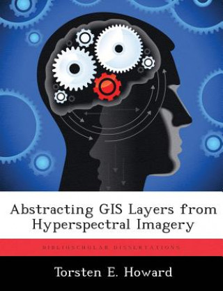
Abstracting GIS Layers from Hyperspectral Imagery
Autor Torsten E Howard
Modern warfare methods in the urban environment necessitates the use of multiple layers of sensors to manage the battle space. Hyperspectral imagers are one possible sensor modality to provide remotely sensed images that can be co ... celý popis
- Jazyk:
 Angličtina
 - Vazba: Brožovaná
- Počet stran: 158
Nakladatelství: Biblioscholar, 2012
- Více informací o knize

Mohlo by se vám také líbit
-

Proscenium Cage
2948 Kč
Darujte tuto knihu ještě dnes
- Objednejte knihu a zvolte Zaslat jako dárek.
- Obratem obdržíte darovací poukaz na knihu, který můžete ihned předat obdarovanému.
- Knihu zašleme na adresu obdarovaného, o nic se nestaráte.
Více informací o knize Abstracting GIS Layers from Hyperspectral Imagery
Nákupem získáte 165 bodů
 Anotace knihy
Modern warfare methods in the urban environment necessitates the use of multiple layers of sensors to manage the battle space. Hyperspectral imagers are one possible sensor modality to provide remotely sensed images that can be converted into Geographic Information Systems (GIS) layers. GIS layers abstract knowledge of roads, buildings, and scene content and contain shape files that outline and highlight scene features. Creating shape files is a labor-intensive and time-consuming process. The availability of shape files that reflect the current configuration of the area of interest significantly enhances Intelligence Preparation of the Battlespace (IPB). The solution presented in this thesis is a novel process to automate the creation of shape files by exploiting the spectral-spatial relationship of a hyperspectral image cube. It is assumed that "a-priori" endmember spectra, a spectral database, or specific scene knowledge is not available. The topological neighborhood of a Self Organizing Map (SOM) is segmented and used as a spectral filter to produce six initial object maps that are spatially processed with logical and morphological operations. A novel road finding algorithm connects road segments under significantly tree-occluded roadways into a contiguous road network. The manual abstraction of GIS shape files is improved into a semi-automated process. The resulting shape files are not susceptible to deviation from orthorectified imagery as they are produced directly from the hyperspectral imagery. The results are eight separate high-quality GIS layers (Vegetation, Non-Tree Vegetation, Trees, Fields, Buildings, Major Buildings, Roadways, and Parking Areas) that follow the terrain of the hyperspectral image and are separately and automatically labeled.
 Parametry knihy
Zařazení knihy Knihy v angličtině Society & social sciences Education
1646 Kč
- Plný název: Abstracting GIS Layers from Hyperspectral Imagery
- Autor: Torsten E Howard
- Jazyk:
 Angličtina
 - Vazba: Brožovaná
- Počet stran: 158
- EAN: 9781288316441
- ISBN: 9781288316441
- ID: 08243263
- Nakladatelství: Biblioscholar
- Hmotnost: 295 g
- Rozměry: 246 × 189 × 9 mm
- Datum vydání: 01. November 2012
Oblíbené z jiného soudku
-

Business Partner B1+ Workbook
462 Kč -

Read Write Inc. Phonics: Red Ditty Book Bag Books (Mixed Pack of 10)
1587 Kč -

Oxford IB Diploma Programme: IB Economics Course Book
1594 Kč -

Business Partner B1 Workbook
434 Kč -

Powerful Teaching: Unleash the Science of Learning
665 Kč -

Speed and Accuracy: Division
208 Kč -
Pearson Edexcel AS and A level Mathematics Statistics & Mechanics Year 1/AS Textbook + e-book
469 Kč -

Speed and Accuracy: Multiplication
228 Kč -

Amazing Autistic Brain Cards
1015 Kč -

North Korea's Military Threat
698 Kč -

Release Your Inner Drive
403 Kč -

Cambridge IGCSE (R) & O Level Complete Physics: Student Book Fourth Edition
929 Kč -

Embodied Teen
545 Kč -

Business Partner B2 Workbook
462 Kč -

Blue Book of Grammar and Punctuation: An Easy- to-Use Guide with Clear Rules, Real-World Examples , and Reproducible Quizzes, Twelfth Edition
393 Kč -

OET Preparation
246 Kč -

KS3 Maths 10-Minute Weekly Workouts - Year 7
199 Kč -

Vertical Academy
919 Kč -

OET Reading Subtest Preparation
343 Kč -

Grade 9-1 GCSE Maths AQA Revision Question Cards - Higher
242 Kč -
Oxford IB Diploma Programme: IB Theory of Knowledge Course Book
1466 Kč -

Positive Discipline Tools for Teachers
433 Kč -

Oxford IB Diploma Programme: IB Course Preparation Mathematics Student Book
992 Kč -
1000 TRIOS or gapped sentences for Cambridge Advanced and Proficiency Exams
608 Kč -
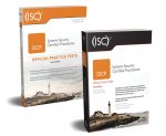
(ISC) SSCP SG & SSCP Practice Test Kit, 3e
1745 Kč -

Czech Verbs
954 Kč -

Motivation and Reinforcement
1161 Kč -

Pearson Edexcel International GCSE (9-1) English Language B Student Book
1328 Kč -

GCSE Spanish Exam Practice Workbook (includes Answers & Free Online Audio)
220 Kč -

Imagine If...
306 Kč -

Oxford International Primary Maths Second Edition: Practice Book 1
323 Kč -

Vol 2 Blackletter Lettering Adventures
635 Kč -

AS & A Level Maths For Dummies
455 Kč -
Forensic Linguistics Articles
417 Kč -

CompTIA Security+ Review Guide - Exam SY0-601
621 Kč -

Abolition of Man
468 Kč -

Human Landscapes from My Country
656 Kč -

Corrected Squares of The Book of Abramelin
14513 Kč -

Hanbo Jutsu: Use of Hanbo, Cane and Walking Stick for Self Defense
284 Kč -

Reading Mind - A Cognitive Approach to Understanding How the Mind Reads
556 Kč -

KS3 Maths 10-Minute Weekly Workouts - Year 8
199 Kč -
Exam Prep for Microeconomics by Pindyck & Rubinfeld, 6th Ed.
1089 Kč -

English Language & Literature WORKBOOK: York Notes for GCSE (9-1)
237 Kč -

Effect of Registration Errors on Tracking in a Networked Radar System
1646 Kč -

Cambridge IGCSE (R) & O Level Complete Chemistry: Student Book Fourth Edition
992 Kč -

Princeton Review SAT Premium Prep, 2021
1136 Kč -

CEH v11 Certified Ethical Hacker Study Guide + Practice Tests Set
1869 Kč -

10 Practice Tests for the SAT, 2021 Edition
841 Kč -
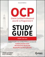
OCP Oracle Certified Professional Java SE 11 Programmer II Study Guide - Exam 1Z0-816 and Exam 1Z0-817
1336 Kč
Osobní odběr Praha, Brno a 12903 dalších
Copyright ©2008-24 nejlevnejsi-knihy.cz Všechna práva vyhrazenaSoukromíCookies


 Vrácení do měsíce
 571 999 099 (8-15.30h)