
Kód: 15347835
The Use of Remote Sensing and GIS to Better Understand Urban Flooding
Autor Joy Agene
This research work was carried out to study the effect of urban growth along a river. Using the Delimi River in Jos Nigeria as a case study; the work investigated how land cover change from 1986 to 2010 has affected flooding in th ... celý popis
- Jazyk:
 Angličtina
 - Vazba: Brožovaná
- Počet stran: 112
Nakladatelství: LAP Lambert Academic Publishing, 2016
- Více informací o knize

Mohlo by se vám také líbit
Dárkový poukaz: Radost zaručena
- Darujte poukaz v libovolné hodnotě a my se postaráme o zbytek.
- Poukaz se vztahuje na celou naši nabídku.
- Elektronický poukaz vytisknete z e-mailu a můžete ihned darovat.
- Platnost poukazu je 12 měsíců od data vystavení.
Více informací o knize The Use of Remote Sensing and GIS to Better Understand Urban Flooding
Nákupem získáte 126 bodů
 Anotace knihy
This research work was carried out to study the effect of urban growth along a river. Using the Delimi River in Jos Nigeria as a case study; the work investigated how land cover change from 1986 to 2010 has affected flooding in the area. The study shows that the vulnerability of people living in the flood prone area increased over the years and this is an indication that the flood event is progressive. Relevant authorities most especially government should provide mitigation measures by setting up flood management policies like converting flood plains and areas liable to flood to open spaces.
 Parametry knihy
1255 Kč
- Plný název: The Use of Remote Sensing and GIS to Better Understand Urban Flooding
- Autor: Joy Agene
- Jazyk:
 Angličtina
 - Vazba: Brožovaná
- Počet stran: 112
- EAN: 9783659915833
- ISBN: 3659915831
- ID: 15347835
- Nakladatelství: LAP Lambert Academic Publishing
- Hmotnost: 183 g
- Rozměry: 220 × 150 × 7 mm
- Datum vydání: 29. October 2016
Oblíbené z jiného soudku
-

Berserk Deluxe Volume 1
1033 Kč -

Haunting Adeline
617 Kč -

Berserk Deluxe Volume 3
1138 Kč -

Berserk Deluxe Volume 2
1056 Kč -
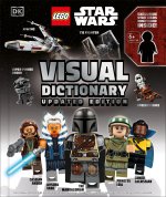
LEGO Star Wars Visual Dictionary Updated Edition
545 Kč -

Atomic Habits
340 Kč -

Powerless
276 Kč -

Chainsaw Man, Vol. 15
251 Kč -

Harry Potter and the Prisoner of Azkaban (Minalima Edition)
978 Kč -

House of Leaves
541 Kč -

Berserk Deluxe Volume 5
1115 Kč -

Hunting Adeline
633 Kč -

Cry Baby Coloring Book
270 Kč -

Iron Flame
353 Kč -

White Nights
90 Kč -

The Official Stardew Valley Cookbook
607 Kč -

JUJUTSU KAISEN V22
241 Kč -

Gravity Falls Journal 3
430 Kč -

Heaven Official's Blessing: Tian Guan Ci Fu (Novel) Vol. 2
442 Kč -

Twisted Lies
276 Kč -

Berserk Deluxe Volume 4
1165 Kč -

Surrounded by Idiots
256 Kč -

Berserk Deluxe Volume 6
1086 Kč -

Dune Messiah
178 Kč -

The 48 Laws of Power
523 Kč -

Twisted Love
276 Kč -

Bungo Stray Dogs, Vol. 8 (light novel)
387 Kč -

Fourth Wing
214 Kč -

Dune
254 Kč -

Twisted Games
276 Kč -

Heaven Official's Blessing: Tian Guan Ci Fu (Novel) Vol. 1
429 Kč -

A Little Life
276 Kč -

CHAINSAW MAN V14
249 Kč -

Court of Thorns and Roses Paperback Box Set (5 books)
1116 Kč -

Berserk Deluxe Volume 10
1163 Kč -

King of Sloth
276 Kč -

Raising Mentally Strong Kids: How to Combine the Power of Neuroscience with Love and Logic to Grow Confident, Kind, Responsible, and Resilient Child
593 Kč -

Vagabond (VIZBIG Edition), Vol. 1
641 Kč -

48 Laws Of Power
372 Kč -

Court of Mist and Fury
254 Kč -

Court of Thorns and Roses
218 Kč -

The Husky and His White Cat Shizun: Erha He Ta de Bai Mao Shizun (Novel) Vol. 5
373 Kč -

No Longer Human
330 Kč -

Heaven Official's Blessing: Tian Guan Ci Fu Vol. 4
441 Kč -

Twisted Series 4-Book Boxed Set
1064 Kč -

Throne of Glass Box Set (Paperback)
2146 Kč -

Powerful
249 Kč -

Dead Poets Society
209 Kč -

A Court of Silver Flames
276 Kč
Osobní odběr Praha, Brno a 12903 dalších
Copyright ©2008-24 nejlevnejsi-knihy.cz Všechna práva vyhrazenaSoukromíCookies







 Vrácení do měsíce
 571 999 099 (8-15.30h)