Kód: 02258448
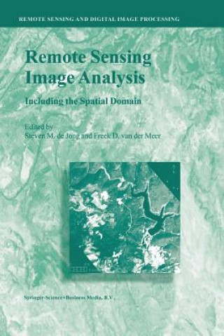
Remote Sensing Image Analysis: Including the Spatial Domain
Autor Steven M. de Jong, Freek D. van der Meer
Remote Sensing image analysis is mostly done using only spectral information on a pixel by pixel basis. Information captured in neighbouring cells, or information about patterns surrounding the pixel of interest often provides use ... celý popis
- Jazyk:
 Angličtina
 - Vazba: Brožovaná
- Počet stran: 359
Nakladatelství: Springer, 2013
- Více informací o knize

3313 Kč

Skladem u dodavatele v malém množství
Odesíláme za 12-15 dnů
Potřebujete více kusů?Máte-li zájem o více kusů, prověřte, prosím, nejprve dostupnost titulu na naši zákaznické podpoře.
Přidat mezi přání
Mohlo by se vám také líbit
-

Milady Standard Natural Hair Care & Braiding
1975 Kč -

Methods in Membrane Biology
1681 Kč -

Looking for Light from the Dark Side of the Moon
418 Kč -

Elementary Properties of the Elliptic Functions, with Examples - Scholar's Choice Edition
704 Kč -
Entwicklung eines Konzeptes zur verbrauchsorientierten Energieverrechnung in der SKF GmbH
1677 Kč -

Marktchancen des digitalen Fernsehens
3876 Kč -

Moeglichkeiten und Grenzen der Entwicklung linearer Optimierungsansatze zur strategischen Unternehmensplanung
3309 Kč
Dárkový poukaz: Radost zaručena
- Darujte poukaz v libovolné hodnotě a my se postaráme o zbytek.
- Poukaz se vztahuje na celou naši nabídku.
- Elektronický poukaz vytisknete z e-mailu a můžete ihned darovat.
- Platnost poukazu je 12 měsíců od data vystavení.
Více informací o knize Remote Sensing Image Analysis: Including the Spatial Domain
Nákupem získáte 331 bodů
 Anotace knihy
Remote Sensing image analysis is mostly done using only spectral information on a pixel by pixel basis. Information captured in neighbouring cells, or information about patterns surrounding the pixel of interest often provides useful supplementary information. This book presents a wide range of innovative and advanced image processing methods for including spatial information, captured by neighbouring pixels in remotely sensed images, to improve image interpretation or image classification. Presented methods include different types of variogram analysis, various methods for texture quantification, smart kernel operators, pattern recognition techniques, image segmentation methods, sub-pixel methods, wavelets and advanced spectral mixture analysis techniques. Apart from explaining the working methods in detail a wide range of applications is presented covering land cover and land use mapping, environmental applications such as heavy metal pollution, urban mapping and geological applications to detect hydrocarbon seeps. §The book is meant for professionals, PhD students and graduates who use remote sensing image analysis, image interpretation and image classification in their work related to disciplines such as geography, geology, botany, ecology, forestry, cartography, soil science, engineering and urban and regional planning.§
 Parametry knihy
Zařazení knihy Knihy v angličtině Earth sciences, geography, environment, planning Earth sciences Geology & the lithosphere
3313 Kč
- Plný název: Remote Sensing Image Analysis: Including the Spatial Domain
- Autor: Steven M. de Jong, Freek D. van der Meer
- Jazyk:
 Angličtina
 - Vazba: Brožovaná
- Počet stran: 359
- EAN: 9789401740616
- ISBN: 9401740615
- ID: 02258448
- Nakladatelství: Springer
- Hmotnost: 575 g
- Rozměry: 235 × 155 × 21 mm
- Datum vydání: 31. May 2013
Oblíbené z jiného soudku
-

Reading the Rocks
383 Kč -

Nature and Properties of Soils, The, Global Edition
2295 Kč -

Past Time: Geology in European and American Art
1064 Kč -
S & S Guide to Rocks and Minerals
582 Kč -

Structural Geology
1676 Kč -

Sea without Fish
983 Kč -
Geological Field Techniques
1934 Kč -
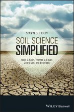
Soil Science Simplified 6e
2720 Kč -
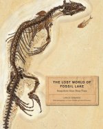
Lost World of Fossil Lake
1064 Kč -

Pleistocene Boundary and the Beginning of the Quaternary
2413 Kč -
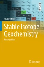
Stable Isotope Geochemistry
2720 Kč -

H2O
303 Kč -

Mycorrhizal Planet
772 Kč -

Story of Earth
347 Kč -
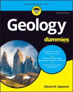
Geology For Dummies
483 Kč -

True Truffle (Tuber spp.) in the World
7468 Kč -

Annals of the Former World
594 Kč -

Environmental Chemistry
3745 Kč -
Radon: A Tracer for Geological, Geophysical and Geochemical Studies
7468 Kč -
The Geology of Kuwait
1135 Kč -
Medical Geology
1973 Kč -

Anthropocene: A Very Short Introduction
254 Kč -

Ice Age
1967 Kč -

Brief History of Geology
1054 Kč -

Rocks: A Very Short Introduction
269 Kč -
Glaciation: A Very Short Introduction
249 Kč -
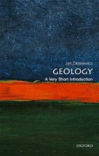
Geology: A Very Short Introduction
249 Kč -

Making of Europe
904 Kč -

Mineral Resources, Economics and the Environment
1949 Kč -
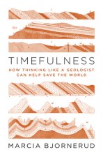
Timefulness
1013 Kč -

Historical Geology
2138 Kč -
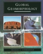
Global Geomorphology
2170 Kč -
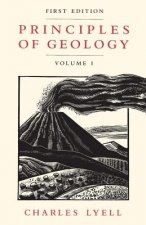
Principles of Geology, Volume 1
802 Kč -
Plate Tectonics: A Very Short Introduction
269 Kč -

Igneous and Metamorphic Petrology 2e
3610 Kč -

Landscapes and Geomorphology: A Very Short Introduction
269 Kč -

Ore Deposit Geology
2006 Kč -

Soil and Environmental Chemistry
3144 Kč -
Tectonic Geomorphology 2e
2976 Kč -
Fossils: A Very Short Introduction
269 Kč -

Earth on Show
1711 Kč -
Quaternary Paleoenvironments - Submerged Landscapes of the European Continental Shelf.
3338 Kč -

Last Giant of Beringia
700 Kč -
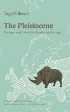
Pleistocene
6578 Kč -
Earth: An Introduction to Physical Geology, Global Edition
2354 Kč -
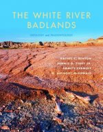
White River Badlands
1036 Kč -
Principles of Geology, Volume 2
1874 Kč -
Principles of Geology, Volume 3
1874 Kč -
Geomorphology
2646 Kč
Osobní odběr Praha, Brno a 12903 dalších
Copyright ©2008-24 nejlevnejsi-knihy.cz Všechna práva vyhrazenaSoukromíCookies


 Vrácení do měsíce
 571 999 099 (8-15.30h)