
Kód: 01323236
Remote Sensing for Ecology and Conservation
Autor Ned Horning
The work of conservation biology has grown from local studies of single species into a discipline concerned with mapping and managing biodiversity on a global scale. Remote sensing, using satellite and aerial imaging to measure an ... celý popis


- Jazyk:
 Angličtina
- Vazba: Brožovaná
- Počet stran: 496
Nakladatelství: Oxford University Press, 2010
- Více informací o knize


Mohlo by se vám také líbit
-

Matrix - Božský zdroj
280 Kč -

Does the Noise in My Head Bother You?
226 Kč -

Harry Potter and the Chamber of Secrets
662 Kč -

Sex Robots & Vegan Meat
319 Kč -

Nibbles the Dinosaur Guide
231 Kč -

Essential Russian Grammar
167 Kč -

Troilus and Criseyde
239 Kč -

MUNDO ORWELL
591 Kč -

Cavemen Sticker Book
189 Kč -

Metatron Revealed - Kabbalistic and Universal Mysteries
390 Kč -

I Love Russian
575 Kč -

Zwiazek z Rudolfem Steinerem
259 Kč -

Standstill clause and its Impact on Turkey-EU relations
1014 Kč -

Guide Pratique Des Incisions Et Sutures
1418 Kč -

WHATS YOUR CHOICE
230 Kč -

Real Estate Guide For Creating Wealth Fast and Retire Early
576 Kč -

Agent-Mediated Electronic Commerce III
1181 Kč -

The Howling II
308 Kč -

LES BARBARESQUES - LE MYTHE ET LA ReALITe
555 Kč -

Buhgalterskij uchet zatrat: metodika osvoeniya
812 Kč -

Malaysia Travel Map Seventh Edition
211 Kč -

What Mental Chemistry Will Do For You And Habit And Personal Supremacy
434 Kč -

EL DRAGON DE SU MAJESTAD
437 Kč -

viaggio
490 Kč -

Transformation: From Old Paradigms to Creative Change
264 Kč -

NICARAGUA - HONDURAS - EL SALVADOR 2015 PETIT FUTE + NUMERIQUE OFFERT
470 Kč -

Nagualismo
279 Kč -
Cambridge Checkpoints VCE Chemistry 2, 2003
260 Kč -

Ultimate Spa
521 Kč -

New Directions In Analytical Political Economy
5150 Kč -

The Spiritual Exercises with Teilhard de Chardin
367 Kč -

Understanding Brain And Mind: A Connectionist Perspective
1571 Kč -

Évasion, Le Tartuffe, lectures en français facile, niveau 3, ESO
450 Kč -

Good People
315 Kč -

The Early Bar of Oneida: A Lecture ...
329 Kč -

Astrology Mundane and Spiritual V2
1151 Kč -

Natur- und Umweltpädagogik für sozialpädagogische Berufe, Arbeitsheft
646 Kč -

Magician
350 Kč -

Power of Yin
435 Kč -

Cambridge Primary World English: Workbook Stage 5
364 Kč -

Structure and Properties of Clusters: from a few Atoms to Nanoparticles
6563 Kč -

Semi-Markov Models and Applications
5460 Kč -

Drought Stress Tolerance in Plants, Vol 1
3530 Kč -

Militar und der Nationalstaat
328 Kč -

Rancher's Secret Sweetheart Comes Back
317 Kč -
How to Hear the Preaching of God's Word with Profit
243 Kč -
Histoire Generale Et Particuliere Du Developpement Des Corps Organises. Tome 1
367 Kč -

Science of Spirit
470 Kč -

Doctrine of the Athanasian Creed Analyzed and Refuted; By a Member of the Church of England. to Which Are Added, Benjamin Ben Mordecai's Queries Respe
447 Kč -

Partition
293 Kč -

Handbook of College Athletics and Recreation Administration
2046 Kč -

The People's Hymn Book
368 Kč -

Islam in the West
40632 Kč -

Albertus
2732 Kč -

Anforderungen an Fachkrafte in der Kindheitspadagogik. Professionalisierung durch Akademisierung?
571 Kč -

Statement of the Case McGuirk Versus Richard
278 Kč
Dárkový poukaz: Radost zaručena
- Darujte poukaz v libovolné hodnotě a my se postaráme o zbytek.
- Poukaz se vztahuje na celou naši nabídku.
- Elektronický poukaz vytisknete z e-mailu a můžete ihned darovat.
- Platnost poukazu je 12 měsíců od data vystavení.
Více informací o knize Remote Sensing for Ecology and Conservation
Nákupem získáte 275 bodů
 Anotace knihy

The work of conservation biology has grown from local studies of single species into a discipline concerned with mapping and managing biodiversity on a global scale. Remote sensing, using satellite and aerial imaging to measure and map the environment, increasingly provides a vital tool for effective collection of the information needed to research and set policy for conservation priorities. The perceived complexities of remotely sensed data and analyses have tended to discourage scientists and managers from using this valuable resource. This text focuses on making remote sensing tools accessible to a larger audience of non-specialists, highlighting strengths and limitations while emphasizing the ways that remotely sensed data can be captured and used, especially for evaluating human impacts on ecological systems.
Parametry knihy
Zařazení knihy Knihy v angličtině Earth sciences, geography, environment, planning Geography Geographical information systems (GIS) & remote sensing
2747 Kč
- Plný název: Remote Sensing for Ecology and Conservation
- Autor: Ned Horning
- Jazyk: Angličtina
- Vazba: Brožovaná
- Počet stran: 496
- EAN: 9780199219957
- ISBN: 0199219958
- ID: 01323236
- Nakladatelství: Oxford University Press
- Hmotnost: 828 g
- Rozměry: 234 × 156 × 23 mm
- Datum vydání: 01. July 2010
Oblíbené z jiného soudku
-

Cartography.
1544 Kč -
Geocaching
358 Kč -

Principles of GNSS, Inertial, and Multisensor Integrated Navigation Systems, Second Edition
3289 Kč -

Mastering QGIS -
1389 Kč -
ArcGIS Pro and ArcGIS Online Applications in Water and Environmental Sciences
1958 Kč -

Semiology of Graphics
2038 Kč -
GIS for Science
1168 Kč -
Geographic Information Science and Systems 4e
5382 Kč -

Mastering Geospatial Analysis with Python
1330 Kč -
Esri Guide to GIS Analysis, Volume 3
1332 Kč -

Introduction to Geographical Information Systems, An
1783 Kč -

Learning ArcGIS Pro
1330 Kč -
Geoinformatics
450 Kč -

Spring Boot Messaging
1039 Kč -
Framework for Geodesign
2123 Kč -

Mastering ArcGIS Server Development with JavaScript
1174 Kč -
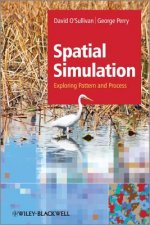
Spatial Simulation - Exploring Pattern and Process
1468 Kč -
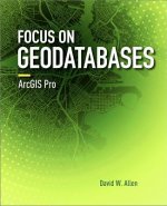
Focus on Geodatabases in ArcGIS Pro
2823 Kč -
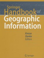
Springer Handbook of Geographic Information
8667 Kč -

Reconstruction and Analysis of 3D Scenes
4000 Kč -
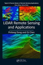
LiDAR Remote Sensing and Applications
3365 Kč -

Programming GPS and OpenStreetMap Applications with Java
2305 Kč -
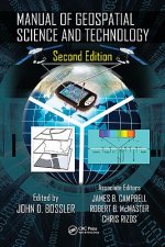
Manual of Geospatial Science and Technology
9279 Kč -
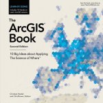
ArcGIS Book
528 Kč -
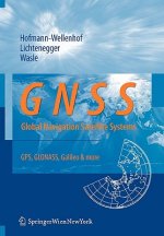
GNSS - Global Navigation Satellite Systems
4258 Kč -
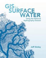
GIS for Surface Water
1736 Kč -
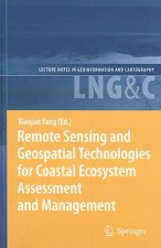
Remote Sensing and Geospatial Technologies for Coastal Ecosystem Assessment and Management
4705 Kč -
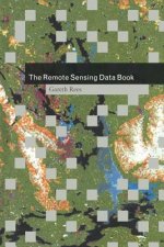
Remote Sensing Data Book
2063 Kč -

QGIS Python Programming Cookbook -
1330 Kč -
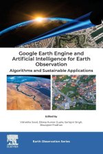
Google Earth Engine and Artificial Intelligence for Earth Observation
3951 Kč -
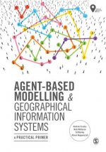
Agent-Based Modelling and Geographical Information Systems
1005 Kč -

Harnessing Earth Observation for Coastal Engineering
4291 Kč -
Sustainable Development and Geospatial Technology
5175 Kč -
Photogrammetry and Remote Sensing
2734 Kč -
Roles of Remote Sensing in Nature Conservation
3765 Kč -

Towards AI Large Model: Remote Sensing Image Intelligent Interpretation and Application
4000 Kč -
Understanding Different Geographies
2356 Kč -
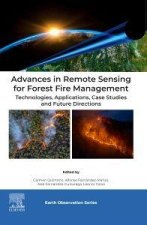
Advances in Remote Sensing for Forest Fire Management
4119 Kč -
Python For ArcGIS
2761 Kč -
Cognitive Aspects of Human-Computer Interaction for Geographic Information Systems
4705 Kč -

Advanced Applications in Remote Sensing of Agricultural Crops and Natural Vegetation
5806 Kč -
Metrics That Make a Difference
3061 Kč -

Innovations in 3D Geo Information Systems
4705 Kč -

Remote Sensing, Big Data, and GeoAI
3683 Kč -

Geospatial Technologies in Environmental Management
3530 Kč -
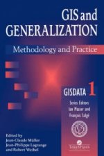
GIS And Generalisation
4721 Kč -
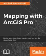
Mapping with ArcGIS Pro
1174 Kč -
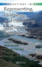
Representing, Modeling, and Visualizing the Natural Environment
4838 Kč -
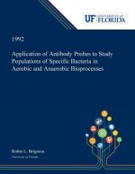
Application of Antibody Probes to Study Populations of Specific Bacteria in Aerobic and Anaerobic Bioprocesses
1253 Kč
Osobní odběr Praha, Brno a 48503 dalších
Copyright ©2008-26 nejlevnejsi-knihy.cz Všechna práva vyhrazenaSoukromíCookies

 Vrácení do měsíce
 571 999 099 (8-15.30h)
