Kód: 04709276
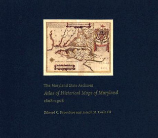
Maryland State Archives Atlas of Historical Maps of Maryland, 1608-1908
Autor Edward C. Papenfuse, Joseph M. Coale, Joseph M. Coale III
Maryland presents cartographers with a formidable test of their skills: unusual natural boundaries, border disputes, and in 1790 the gift of sixty-seven square miles for the creation of the District of Columbia have given the stat ... celý popis
- Jazyk:
 Angličtina
 - Vazba: Pevná
- Počet stran: 240
Nakladatelství: Johns Hopkins University Press, 2003
- Více informací o knize

2886 Kč
Dostupnost:
50 % šance Máme informaci, že by titul mohl být dostupný. Na základě vaší objednávky se ho pokusíme do 6 týdnů zajistit.
Prohledáme celý svět
Mohlo by se vám také líbit
-

Seal Surfer
252 Kč -

Credo
423 Kč -

Charlie, Meg and Me
312 Kč
Dárkový poukaz: Radost zaručena
- Darujte poukaz v libovolné hodnotě a my se postaráme o zbytek.
- Poukaz se vztahuje na celou naši nabídku.
- Elektronický poukaz vytisknete z e-mailu a můžete ihned darovat.
- Platnost poukazu je 12 měsíců od data vystavení.
Informovat o naskladnění knihy
Zadejte do formuláře e-mailovou adresu a jakmile knihu naskladníme, zašleme vám o tom zprávu. Pohlídáme vše za vás.
Více informací o knize Maryland State Archives Atlas of Historical Maps of Maryland, 1608-1908
Nákupem získáte 289 bodů
 Anotace knihy
Maryland presents cartographers with a formidable test of their skills: unusual natural boundaries, border disputes, and in 1790 the gift of sixty-seven square miles for the creation of the District of Columbia have given the state a distinctively irregular configuration. Since the early seventeenth century, generations of mapmakers have met this challenge with artistic imagination and a variety of cartographical techniques. In The Maryland State Archives Atlas of Historical Maps of Maryland, 1608-1908, Edward C. Papenfuse and Joseph M. Coale III bring together in one volume the results of these remarkable efforts, from Captain John Smith's 1608 detailed sketch of the region to the map resulting from the Supreme Court's determination of the state's western border in 1908. Utilizing the latest digital imaging and printing technology, the Atlas contains stunning, full-color reproductions of more than 250 of the most significant historical maps from state and federal archives. This handsome and informative collection-a thoroughly updated and greatly expanded version of the authors' landmark book, The Hammond-Harwood House Atlas of Historical Maps of Maryland (1982)-provides an in-depth history of mapmaking in Maryland and charts the state's early settlement patterns.
 Parametry knihy
Zařazení knihy Knihy v angličtině Humanities History History: specific events & topics
2886 Kč
- Plný název: Maryland State Archives Atlas of Historical Maps of Maryland, 1608-1908
- Autor: Edward C. Papenfuse, Joseph M. Coale, Joseph M. Coale III
- Jazyk:
 Angličtina
 - Vazba: Pevná
- Počet stran: 240
- EAN: 9780801872358
- ID: 04709276
- Nakladatelství: Johns Hopkins University Press
- Hmotnost: 2428 g
- Rozměry: 369 × 318 × 22 mm
- Datum vydání: 25. April 2003
Oblíbené z jiného soudku
-

Man's Search for Meaning
179 Kč -

Women, Race & Class
276 Kč -

Pianist
211 Kč -

Out Of Place
303 Kč -

Little History of Economics
350 Kč -

Laughter in Ancient Rome
501 Kč -

Civilization and Capitalism, 15th-18th Century
1611 Kč -

Armies of Medieval Burgundy 1364-1477
395 Kč -

Night
249 Kč -

Society of the Spectacle
291 Kč -

Imperialism: The Highest Stage of Capitalism
196 Kč -

Man's Search For Meaning
410 Kč -

Homo Deus
265 Kč -

Ordinary Men
306 Kč -

Black Earth
358 Kč -

The Complete MAUS
462 Kč -

The Rape of Nanking
441 Kč -

Madness and Civilization
419 Kč -

Conquerors
306 Kč -

Stoned
276 Kč -

Twelve Years a Slave
90 Kč -

At Home
303 Kč -

Origins of Museums
1370 Kč -

Measure of a Man
373 Kč -

Delirious New York
679 Kč -

Eichmann in Jerusalem
306 Kč -

Mein Kampf - The Ford Translation
985 Kč -

Bloodlands
358 Kč -

Guns, Germs and Steel
358 Kč -

Cold War Submarines
865 Kč -

Fall of Public Man
410 Kč -

Che Guevara
551 Kč -

Dancing In The Streets
303 Kč -

Fix the Pumps
351 Kč -

Blue
954 Kč -

Revolutionary Yiddishland
336 Kč -

Commandant Of Auschwitz
303 Kč -

Jewish State
277 Kč -

Eichmann in Jerusalem
357 Kč -

Reflections on the Revolution in France
249 Kč -

Wall Street and the Bolshevik Revolution
357 Kč -

Corgi Toys
407 Kč -

Night
276 Kč -

Wreck of the Titan
306 Kč -

McMafia
303 Kč -

Intimate History of Humanity
357 Kč -

Feminism: A Very Short Introduction
249 Kč -

White Gold
357 Kč -

Twelve Who Ruled
600 Kč
Osobní odběr Praha, Brno a 12903 dalších
Copyright ©2008-24 nejlevnejsi-knihy.cz Všechna práva vyhrazenaSoukromíCookies


 Vrácení do měsíce
 571 999 099 (8-15.30h)