Kód: 33354509
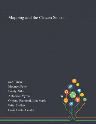
Mapping and the Citizen Sensor
Autor Linda See, Peter Mooney, Giles Foody
Maps are a fundamental resource in a diverse array of applications ranging from everyday activities, such as route planning through the legal demarcation of space to scientific studies, such as those seeking to understand biodiver ... celý popis


- Jazyk:
 Angličtina
 - Vazba: Brožovaná
- Počet stran: 402
Nakladatelství: Saint Philip Street Press, 2020
- Více informací o knize


Mohlo by se vám také líbit
-

Michael Jackson: Number Ones: Easy Piano
475 Kč -

Secrets of Sir Richard Kenworthy
295 Kč -

La porcelaine de Limoges
199 Kč -

Diccionario de autoridades. Tomo VI
851 Kč -

Inerrancy and the Gospels
477 Kč -

Muskegon Lumberjacks-The Life of a Hockey Puck!
279 Kč -
Cuestiones esenciales en la jurisprudencia de la Corte Penal Internacional
311 Kč -

diary of a samaritan
529 Kč -
Comprendere Le Donne: Manuale pratico sul Linguaggio Non Verbale per Comprendere e Sedurre le Donne al primo incontro
449 Kč -

Love Story of Herb la Fouche
388 Kč -

Level of Physical Activity and Clinical Outcomes of Patients with ACS
489 Kč -

Mary's Fairy Learns To Exercise
354 Kč -

Substance of the Evidence of Sundry Persons on the Slave-Trade, Collected in the Course of a Tour Made in the Autumn of the Year 1788.
507 Kč -

Extraordinary Living: Living above the ordinary
237 Kč
Dárkový poukaz: Radost zaručena
- Darujte poukaz v libovolné hodnotě a my se postaráme o zbytek.
- Poukaz se vztahuje na celou naši nabídku.
- Elektronický poukaz vytisknete z e-mailu a můžete ihned darovat.
- Platnost poukazu je 12 měsíců od data vystavení.
Více informací o knize Mapping and the Citizen Sensor
Nákupem získáte 90 bodů
 Anotace knihy
Maps are a fundamental resource in a diverse array of applications ranging from everyday activities, such as route planning through the legal demarcation of space to scientific studies, such as those seeking to understand biodiversity and inform the design of nature reserves for species conservation. For a map to have value, it should provide an accurate and timely representation of the phenomenon depicted and this can be a challenge in a dynamic world. Fortunately, mapping activities have benefitted greatly from recent advances in geoinformation technologies. Satellite remote sensing, for example, now offers unparalleled data acquisition and authoritative mapping agencies have developed systems for the routine production of maps in accordance with strict standards. Until recently, much mapping activity was in the exclusive realm of authoritative agencies but technological development has also allowed the rise of the amateur mapping community. The proliferation of inexpensive and highly mobile and location aware devices together with Web 2.0 technology have fostered the emergence of the citizen as a source of data. Mapping presently benefits from vast amounts of spatial data as well as people able to provide observations of geographic phenomena, which can inform map production, revision and evaluation. The great potential of these developments is, however, often limited by concerns. The latter span issues from the nature of the citizens through the way data are collected and shared to the quality and trustworthiness of the data. This book reports on some of the key issues connected with the use of citizen sensors in mapping. It arises from a European Co-operation in Science and Technology (COST) Action, which explored issues linked to topics ranging from citizen motivation, data acquisition, data quality and the use of citizen derived data in the production of maps that rival, and sometimes surpass, maps arising from authoritative agencies.
This work was published by Saint Philip Street Press pursuant to a Creative Commons license permitting commercial use. All rights not granted by the work's license are retained by the author or authors.
Parametry knihy
Zařazení knihy Knihy v angličtině Earth sciences, geography, environment, planning Geography
903 Kč
- Plný název: Mapping and the Citizen Sensor
- Autor: Linda See, Peter Mooney, Giles Foody
- Jazyk: Angličtina
- Vazba: Brožovaná
- Počet stran: 402
- EAN: 9781013288708
- ISBN: 101328870X
- ID: 33354509
- Nakladatelství: Saint Philip Street Press
- Hmotnost: 925 g
- Rozměry: 279 × 216 × 21 mm
- Datum vydání: 09. October 2020
Oblíbené z jiného soudku
-
IB Diploma
1140 Kč -

Geography: An Integrated Approach
2239 Kč -

Birds of New Guinea
879 Kč -
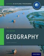
Oxford IB Diploma Programme: Geography Course Companion
1706 Kč -

tiptoi® Weltatlas
480 Kč -
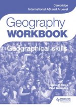
Cambridge International AS and A Level Geography Skills Workbook
498 Kč -
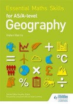
Essential Maths Skills for AS/A-level Geography
173 Kč -
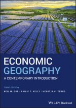
Economic Geography - A Contemporary Introduction 3e
1189 Kč -

Stranger Magic
428 Kč -

Tambora and the Year without a Summer - How a Volcano Plunged the World into Crisis
572 Kč -

Uneven Development
714 Kč -

Paradoxes of Segregation - Housing Systems, Welfare Regimes and Ethnic Residential Change in Southern European Cities
753 Kč -
Great Acceleration
591 Kč -
Models of Spatial Processes
1061 Kč -
IB Geography Course Book: Oxford IB Diploma Programme
995 Kč -
IB Geography Study Guide: Oxford IB Diploma Programme
1293 Kč -

DANUBE BIKE TRAIL 1 DONAUESCHINGEN TO PA
405 Kč -

Cambridge International AS & A Level Geography Student's Book
1209 Kč -

Justinianic Mosaics of Hagia Sophia and Their Aftermath
2290 Kč -
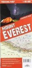
terraQuest Trekking Map Mount Everest
257 Kč -
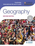
Cambridge International AS and A Level Geography second edition
1998 Kč -
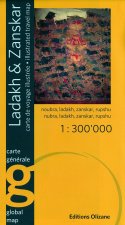
LADAKH ZANSKAR OLIZANE RV WP
660 Kč -

Geospatial Analysis
1435 Kč -
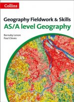
Level Geography Fieldwork & Skills
1651 Kč -
Butterflies of Europe
672 Kč -

Geology of the Oman Mountains, Eastern Arabia
1299 Kč -

Birds of Hawaii and Micronesia
533 Kč -

Geography for Cambridge International AS and A Level Revision Guide
843 Kč -

History of the Adriatic: A Sea and Its Civilizatio n Cloth
2075 Kč -

Ancient India as described by Megasthenes and Arrian. Being a translation of the fragments of the Indika of Megasthenes, collected by Dr. Schwanbeck.
615 Kč -

Urban Planning Imagination - A Critical International Introduction
582 Kč -
Dictionary of Physical Geography, 4e
1064 Kč -
Geography
894 Kč -
Havana / Cuba Central
285 Kč -

Do Earth
244 Kč -

Birds of Prey of the East
491 Kč -

Incredible History of India'a Geography
191 Kč -

Human Geography
1087 Kč -

Garibaldi
1639 Kč -

Manga from the Floating World
855 Kč -

Geology of Egypt
810 Kč -

Manual of Coal and Its Topography. Illustrated by Original Drawings.
471 Kč -

Future of Packaging
531 Kč -
Affective Urbanism
1182 Kč -

Birds of Prey of the West
586 Kč -

Once Within Borders
860 Kč -

New Literary History of Modern China
1285 Kč -
Macedonia
207 Kč -

Political Essay on the Kingdom of New Spain, Volume 1
1703 Kč
Osobní odběr Praha, Brno a 46961 dalších
Copyright ©2008-26 nejlevnejsi-knihy.cz Všechna práva vyhrazenaSoukromíCookies

 Vrácení do měsíce
 571 999 099 (8-15.30h)