Kód: 01566693
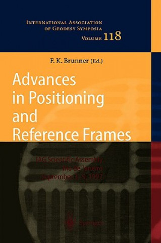
Advances in Positioning and Reference Frames
Autor Fritz K. Brunner
This volume is based on an international symposium held in Rio de Janeiro. It gives a progress report on geodetic positioning with GPS. The maintenance and the densification of reference frames are treated for the purpose of estab ... celý popis


- Jazyk:
 Angličtina
 - Vazba: Pevná
- Počet stran: 398
Nakladatelství: Springer-Verlag Berlin and Heidelberg GmbH & Co. KG, 1998
- Více informací o knize

5236 Kč

Skladem u dodavatele v malém množství
Odesíláme za 13-18 dnů
Potřebujete více kusů?Máte-li zájem o více kusů, prověřte, prosím, nejprve dostupnost titulu na naši zákaznické podpoře.
Přidat mezi přání
Mohlo by se vám také líbit
-

New Close-Up A2 with Online Practice and Student's eBook
1107 Kč -

Little Guides to Style: The Classics
1034 Kč -

Ricorumi Set 20er "Weihnachtskrippe"
682 Kč -

Jednoduché spojovačky 1-10 bodů/bodov
71 Kč -

Солодких снів, маленький
312 Kč -

Treasury of Nursery Rhymes and Poems
380 Kč -

Die fabelhafte Welt des Watercolor
385 Kč -

ODIARAS A TU PADRE SOBRE TODAS LAS COSAS
449 Kč -

Exploring the Political Economy and Social Philosophy of F. A. Hayek
1309 Kč -

Viking Mythology
382 Kč -

Art as Therapy: An Introduction to the Use of Art as a Therapeutic Technique
3875 Kč -

Děvčata z koncentračního tábora Gross-Rosen
307 Kč -

Wonderful World of Words Volume 7: The Queen's Best Friend
128 Kč -

Psychoanalytic Study of the Child
1655 Kč -

Guide de Nantes en Bandes dessinées
636 Kč -

The Last Great Fight: The Extraordinary Tale of Two Men and How One Fight Changed Their Lives Forever
425 Kč -

Wood Pallet Projects: 10 Modern Wood Pallet Projects For Your Bedroom
216 Kč -

Influence of Values on Consumer Behaviour
5435 Kč -

Hybrid Play
5510 Kč -

The Culture of Greenhouse Orchids: Old System and New
663 Kč -

Back Then
382 Kč -

Visualisierung und Bearbeitung von 3D Animationspfaden
1209 Kč -

partigiano in canonica e altre storie in Garfagnana
418 Kč -

Differenzierung bei Schulerinnen und Schulern mit dem sonderpadagogischen Foerderbedarf "geistige Entwicklung
571 Kč -

On Food and its Digestion
711 Kč -

Kriminologische Aspekte voelkerrechtlicher Verbrechen
653 Kč -

Study Guide for Edward Albee's Three Tall Women
271 Kč -

Oxford Handbook of Modern Scottish History
1116 Kč -

Dibaxu
440 Kč -

La naveta des tudons i el pou de sa barrina
181 Kč -

Lapwing's Song: Octave of Life
299 Kč -

Workplace Skills: Locating Information, Value Set (25 Copies)
24079 Kč -

The the Cow That Went Oink
475 Kč -

CUERPO ADMINISTRATIVO ADMINISTRACION COMUNIDAD A
1044 Kč -

Izolaty bakteryjne i antibiogramy
732 Kč -

Female Captive
728 Kč -

La fiesta en la habitación de al lado
421 Kč -

Mountains of the Heart
324 Kč -

Le carnet de Jacques - Lignes, 96p, A5 - Bikers
258 Kč -

Plain suggestions for a reverent celebration
267 Kč -

Generic Environmental Impact Statement for License Renewal of Nuclear Plants: Public Comments
526 Kč -

Parteien und Foederalismus in der Luftreinhaltepolitik der USA
328 Kč
Dárkový poukaz: Radost zaručena
- Darujte poukaz v libovolné hodnotě a my se postaráme o zbytek.
- Poukaz se vztahuje na celou naši nabídku.
- Elektronický poukaz vytisknete z e-mailu a můžete ihned darovat.
- Platnost poukazu je 12 měsíců od data vystavení.
Více informací o knize Advances in Positioning and Reference Frames
Nákupem získáte 524 bodů
 Anotace knihy
This volume is based on an international symposium held in Rio de Janeiro. It gives a progress report on geodetic positioning with GPS. The maintenance and the densification of reference frames are treated for the purpose of establishing global and regional GPS networks. The scientific achievements of the South American Geocentric Reference System project (SIRGAS) are described. Several contributions review the state of the art of GPS analysis techniques, ambiguity resolution methods, as well as GPS antenna and site problems. Novel applications of kinematic GPS positioning and quality control issues of real-time GPS positioning are discussed.
Parametry knihy
Zařazení knihy Knihy v angličtině Earth sciences, geography, environment, planning Geography Geodesy & surveying for maps & charts
5236 Kč
- Plný název: Advances in Positioning and Reference Frames
- Autor: Fritz K. Brunner
- Jazyk: Angličtina
- Vazba: Pevná
- Počet stran: 398
- EAN: 9783540646044
- ISBN: 3540646043
- ID: 01566693
- Nakladatelství: Springer-Verlag Berlin and Heidelberg GmbH & Co. KG
- Hmotnost: 1670 g
- Rozměry: 234 × 156 × 27 mm
- Datum vydání: 25. August 1998
Oblíbené z jiného soudku
-

Theory of Satellite Geodesy
241 Kč -

Conformal Mapping
524 Kč -

Window on the Future of Geodesy
8264 Kč -

Ecological Classification of Saskatchewn's Mid-Boreal Ecoregions Using Resource Maps and Aerial Photographs
515 Kč -

Introduction to Geodesy: The History and Concepts of Modern Geodesy
3014 Kč -

Precision Surveying - The Principles and Geomatics Practice
4233 Kč -

Theory of Satellite Geodesy and Gravity Field Determination
1182 Kč -

Vrancea Earthquakes: Tectonics, Hazard and Risk Mitigation
4059 Kč -

Applied Geodesy
1182 Kč -

Mathematical Foundation of Geodesy
4707 Kč -

VI Hotine-Marussi Symposium on Theoretical and Computational Geodesy
4707 Kč -

History of Spaces
6155 Kč -

Gravity, Geoid and Space Missions
5236 Kč -

Recent Geodetic and Gravimetric Research in Latin America
2357 Kč -

History of the International Polar Years (IPYs)
4707 Kč -

Shooting Polaris
735 Kč -

IV Hotine-Marussi Symposium on Mathematical Geodesy
5236 Kč -

Earth Sciences in the Age of the Satellite
2646 Kč -

History of Spaces
1848 Kč -

Geoid Determination
7057 Kč -

Aerial Surveying by Rapid Methods
914 Kč -

Interdisciplinary Role of Space Geodesy
1182 Kč -

Full Meridian of Glory
575 Kč -

Satellite Geodesy
2051 Kč -

John Norden's The Surveyor's Dialogue (1618)
5435 Kč -

Geodetic Theory Today
2357 Kč -

Applications of Geodesy to Engineering
2646 Kč -

Introduction to Regional Surveying
914 Kč -

Sensing and Monitoring Technologies for Mines and Hazardous Areas
3464 Kč
Osobní odběr Praha, Brno a 46922 dalších
Copyright ©2008-26 nejlevnejsi-knihy.cz Všechna práva vyhrazenaSoukromíCookies

 Vrácení do měsíce
 571 999 099 (8-15.30h)