Kód: 04478585
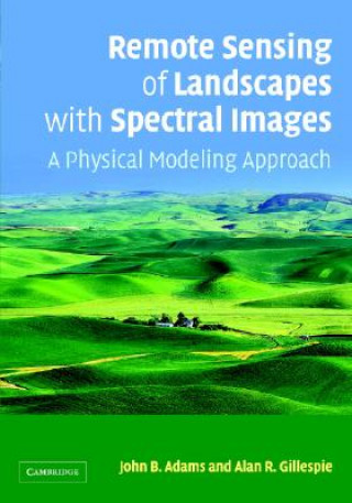
Remote Sensing of Landscapes with Spectral Images
Autor John B Adams
Remote Sensing of Landscapes with Spectral Images describes how to process and interpret spectral images using physical models to bridge the gap between the engineering and theoretical sides of remote-sensing and the world that we ... celý popis
- Jazyk:
 Angličtina
 - Vazba: Pevná
- Počet stran: 378
Nakladatelství: Cambridge University Press, 2006
- Více informací o knize

4420 Kč
Dostupnost:
50 % šance Máme informaci, že by titul mohl být dostupný. Na základě vaší objednávky se ho pokusíme do 6 týdnů zajistit.
Prohledáme celý svět
Mohlo by se vám také líbit
Dárkový poukaz: Radost zaručena
- Darujte poukaz v libovolné hodnotě a my se postaráme o zbytek.
- Poukaz se vztahuje na celou naši nabídku.
- Elektronický poukaz vytisknete z e-mailu a můžete ihned darovat.
- Platnost poukazu je 12 měsíců od data vystavení.
Informovat o naskladnění knihy
Zadejte do formuláře e-mailovou adresu a jakmile knihu naskladníme, zašleme vám o tom zprávu. Pohlídáme vše za vás.
Více informací o knize Remote Sensing of Landscapes with Spectral Images
Nákupem získáte 442 bodů
 Anotace knihy
Remote Sensing of Landscapes with Spectral Images describes how to process and interpret spectral images using physical models to bridge the gap between the engineering and theoretical sides of remote-sensing and the world that we encounter when we venture outdoors. The emphasis is on the practical use of images rather than on theory and mathematical derivations. Examples are drawn from a variety of landscapes and interpretations are tested against the reality seen on the ground. The reader is led through analysis of real images (using figures and explanations); the examples are chosen to illustrate important aspects of the analytic framework. This textbook will form a valuable reference for graduate students and professionals in a variety of disciplines including ecology, forestry, geology, geography, urban planning, archaeology and civil engineering. It is supplemented by a web-site hosting digital colour versions of figures in the book as well as ancillary images: www.cambridge.org/9780521662214.
 Parametry knihy
Zařazení knihy Knihy v angličtině Earth sciences, geography, environment, planning Geography Geographical information systems (GIS) & remote sensing
4420 Kč
- Plný název: Remote Sensing of Landscapes with Spectral Images
- Autor: John B Adams
- Jazyk:
 Angličtina
 - Vazba: Pevná
- Počet stran: 378
- EAN: 9780521662215
- ISBN: 0521662214
- ID: 04478585
- Nakladatelství: Cambridge University Press
- Hmotnost: 928 g
- Rozměry: 182 × 254 × 23 mm
- Datum vydání: 18. April 2006
Oblíbené z jiného soudku
-
Designing Better Maps
1911 Kč -

Cartography.
1859 Kč -

Mastering Geospatial Analysis with Python
1564 Kč -

Semiology of Graphics
3423 Kč -

Geographic Information Science and Systems 4e
5566 Kč -
GIS for Science
1248 Kč -
Geocaching
479 Kč -

Introduction to Geographical Information Systems, An
2042 Kč -

Connections and Content
1284 Kč -
Focus on Geodatabases in ArcGIS Pro
1731 Kč -

Framework for Geodesign
2537 Kč -
Esri Guide to GIS Analysis, Volume 3
1447 Kč -

Springer Handbook of Geographic Information
10603 Kč -

Reconstruction and Analysis of 3D Scenes
4859 Kč -
Geoinformatics
926 Kč -

Mastering ArcGIS Server Development with JavaScript
1398 Kč -
LiDAR Remote Sensing and Applications
3343 Kč -
GIS For Dummies
992 Kč -

ArcGIS Book
671 Kč -
Python For ArcGIS
3611 Kč -

Spring Boot Messaging
1384 Kč -
GNSS - Global Navigation Satellite Systems
5985 Kč -

GIS in Land and Property Management
7887 Kč -
Spatial Statistics and Geostatistics
2135 Kč -

Programming GPS and OpenStreetMap Applications with Java
2310 Kč -
European Landscape Dynamics
6712 Kč -
Satellite Interferometry Data Interpretation and Exploitation
4814 Kč -

Introduction to GIS Programming and Fundamentals with Python and ArcGIS (R)
3664 Kč -
Error Propagation in Environmental Modelling with GIS
3966 Kč -

QGIS Python Programming Cookbook -
1564 Kč -

Learning ArcGIS Pro
1564 Kč -

GPS For Dummies 2e
634 Kč -
Introducing Geographic Information Systems with ArcGIS - A Workbook Approach to Learning GIS, Third Edition
3284 Kč -

Mastering QGIS -
1730 Kč -
Integration of GIS and Remote Sensing
6884 Kč -

Energy of Nations
1339 Kč -
Physical Principles of Remote Sensing
5223 Kč -

New Developments and Environmental Applications of Drones
5391 Kč -

GIS and Spatial Analysis for the Social Sciences
3190 Kč -

Satellite Altimetry Over Oceans and Land Surfaces
6983 Kč -

Mapping with ArcGIS Pro
1398 Kč -

Learning QGIS 2.0
788 Kč -
Open Source GIS
5094 Kč -
ArcGIS Pro and ArcGIS Online Applications in Water and Environmental Sciences
2259 Kč -
Geographic Information Systems (GIS)
8779 Kč -
Geographical Information Science
2693 Kč -

Spatial Conservation Prioritization
6105 Kč -

Digital Terrain Modelling
5094 Kč -
Thermal Infrared Remote Sensing
5362 Kč
Osobní odběr Praha, Brno a 12903 dalších
Copyright ©2008-24 nejlevnejsi-knihy.cz Všechna práva vyhrazenaSoukromíCookies


 Vrácení do měsíce
 571 999 099 (8-15.30h)