Kód: 41905407
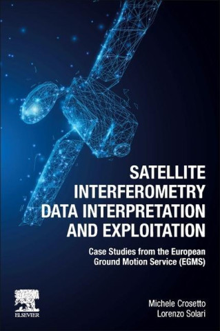
Satellite Interferometry Data Interpretation and Exploitation
Autor Michele Crosetto, Lorenzo Solari
Satellite Interferometry Data Interpretation and Exploitation: Case Studies from the European Ground Motion Service (EGMS) focuses on the interpretation and exploitation of data obtained from InSAR, enabling millimeter-scale defor ... celý popis
- Jazyk:
 Angličtina
 - Vazba: Brožovaná
- Počet stran: 254
Nakladatelství: Elsevier, 2023
- Více informací o knize

4814 Kč
Dostupnost:
50 % šance Máme informaci, že by titul mohl být dostupný. Na základě vaší objednávky se ho pokusíme do 6 týdnů zajistit.
Prohledáme celý svět
Mohlo by se vám také líbit
-
Satellite Radar Interferometry
4488 Kč -

Pokemon Adventures: Black and White, Vol. 1
223 Kč -

Unfolding Of Language
323 Kč -

SAS Survival Handbook
553 Kč -

Haute Bohemians
1499 Kč -

Signs & Symbols
543 Kč -

Černá ovce facebooku
244 Kč
Dárkový poukaz: Radost zaručena
- Darujte poukaz v libovolné hodnotě a my se postaráme o zbytek.
- Poukaz se vztahuje na celou naši nabídku.
- Elektronický poukaz vytisknete z e-mailu a můžete ihned darovat.
- Platnost poukazu je 12 měsíců od data vystavení.
Informovat o naskladnění knihy
Zadejte do formuláře e-mailovou adresu a jakmile knihu naskladníme, zašleme vám o tom zprávu. Pohlídáme vše za vás.
Více informací o knize Satellite Interferometry Data Interpretation and Exploitation
Nákupem získáte 481 bodů
 Anotace knihy
Satellite Interferometry Data Interpretation and Exploitation: Case Studies from the European Ground Motion Service (EGMS) focuses on the interpretation and exploitation of data obtained from InSAR, enabling millimeter-scale deformation measurements from space. The most emblematic InSAR service, the European Ground Motion Service (EGMS), opens a wide range of new applications. However, for effective use of this raw data, interpretation techniques and methods are required. This book presents interpretation protocols that can be applied to any InSAR data, as well as the most relevant technical aspects and boundaries of measurement points through linking them to real results through detailed case studies. Satellite Interferometry Data Interpretation and Exploitation is a valuable resource for remote sensing specialists, as well as non-specialists in geotechnics, geology, and other geosciences looking to apply InSAR data techniques in their research. Provides user-oriented techniques, for better understanding of the applications of InSAR and the European Ground Motion Service (EGMS) Features case studies based on manipulation of EGMS data, showing new applications of InSAR data interpretation Details InSAR and EGMS potential and limitations for the exploitation of InSAR data
 Parametry knihy
Zařazení knihy Knihy v angličtině Earth sciences, geography, environment, planning Geography Geographical information systems (GIS) & remote sensing
4814 Kč
- Plný název: Satellite Interferometry Data Interpretation and Exploitation
- Podnázev: Case Studies from the European Ground Motion Service (EGMS)
- Autor: Michele Crosetto, Lorenzo Solari
- Jazyk:
 Angličtina
 - Vazba: Brožovaná
- Počet stran: 254
- EAN: 9780443133978
- ID: 41905407
- Nakladatelství: Elsevier
- Datum vydání: 01. June 2023
Oblíbené z jiného soudku
-

Designing Better Maps
1489 Kč -

Cartography.
1647 Kč -

Mastering Geospatial Analysis with Python
1533 Kč -

Semiology of Graphics
2793 Kč -

Geographic Information Science and Systems 4e
5561 Kč -
GIS for Science
1150 Kč -

Geocaching
481 Kč -

Introduction to Geographical Information Systems, An
2011 Kč -

Connections and Content
1358 Kč -

Focus on Geodatabases in ArcGIS Pro
1711 Kč -

Framework for Geodesign
2270 Kč -

Esri Guide to GIS Analysis, Volume 3
1291 Kč -

Springer Handbook of Geographic Information
10374 Kč -

Reconstruction and Analysis of 3D Scenes
5083 Kč -

Geoinformatics
908 Kč -

Mastering ArcGIS Server Development with JavaScript
1370 Kč -

LiDAR Remote Sensing and Applications
3343 Kč -

GIS For Dummies
986 Kč -

ArcGIS Book
592 Kč -

Python For ArcGIS
3584 Kč -

Spring Boot Messaging
1423 Kč -
GNSS - Global Navigation Satellite Systems
5355 Kč -

GIS in Land and Property Management
6903 Kč -

Spatial Statistics and Geostatistics
2086 Kč -

Programming GPS and OpenStreetMap Applications with Java
2309 Kč -

European Landscape Dynamics
6520 Kč -

Introduction to GIS Programming and Fundamentals with Python and ArcGIS (R)
3584 Kč -

Error Propagation in Environmental Modelling with GIS
3880 Kč -

QGIS Python Programming Cookbook -
1532 Kč -

Learning ArcGIS Pro
1532 Kč -

GPS For Dummies 2e
662 Kč -

Mastering QGIS -
1695 Kč -

Introducing Geographic Information Systems with ArcGIS - A Workbook Approach to Learning GIS, Third Edition
3002 Kč -

Integration of GIS and Remote Sensing
6745 Kč -

Energy of Nations
1310 Kč -

Physical Principles of Remote Sensing
4858 Kč -

New Developments and Environmental Applications of Drones
5561 Kč -

Mapping with ArcGIS Pro
1370 Kč -

GIS and Spatial Analysis for the Social Sciences
3190 Kč -

Satellite Altimetry Over Oceans and Land Surfaces
6903 Kč -

Learning QGIS 2.0
772 Kč -

Open Source GIS
5060 Kč -

ArcGIS Pro and ArcGIS Online Applications in Water and Environmental Sciences
2260 Kč -

Recent Advances in Remote Sensing for Crop Growth Monitoring
2666 Kč -

Spatial Conservation Prioritization
6104 Kč -

Artificial Intelligence in Geography
8972 Kč -

Geolocation in iOS
607 Kč -

Spatial Data Mining
2699 Kč -

Thermal Infrared Remote Sensing
5326 Kč
Osobní odběr Praha, Brno a 12903 dalších
Copyright ©2008-24 nejlevnejsi-knihy.cz Všechna práva vyhrazenaSoukromíCookies


 Vrácení do měsíce
 571 999 099 (8-15.30h)