Kód: 14265637
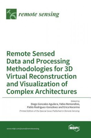
Remote Sensed Data and Processing Methodologies for 3D Virtual Reconstruction and Visualization of Complex Architectures
Remote Sensing | Special Issue : Remote Sensed Data and Processing Methodologies for 3D Virtual Reconstruction and Visualization of Complex Architectures In recent years, th ... celý popis
- Jazyk:
 Angličtina
 - Vazba: Pevná
- Počet stran: 602
Nakladatelství: Mdpi AG, 2016
- Více informací o knize

Mohlo by se vám také líbit
-

BOYS AND MEN: A STORY OF LIFE AT YALE
981 Kč -

McKinney
746 Kč -

Prisoner No. 100 - An Account of My Days and Nights in an Indian Prison
567 Kč -

Technology for Physical Education Teacher Education
1230 Kč -

From Sacred Waters and Pagan Goddesses to Holy Wells: the Cult of Saints and the Virgin Mary in Medieval Britain
433 Kč -

New Super-Man Vol. 2: Coming to America (Rebirth)
463 Kč -

Fiscal Policies in Federal States
2999 Kč
Darujte tuto knihu ještě dnes
- Objednejte knihu a zvolte Zaslat jako dárek.
- Obratem obdržíte darovací poukaz na knihu, který můžete ihned předat obdarovanému.
- Knihu zašleme na adresu obdarovaného, o nic se nestaráte.
Více informací o knize Remote Sensed Data and Processing Methodologies for 3D Virtual Reconstruction and Visualization of Complex Architectures
Nákupem získáte 382 bodů
 Anotace knihy
Remote Sensing | Special Issue : Remote Sensed Data and Processing Methodologies for 3D Virtual Reconstruction and Visualization of Complex Architectures In recent years, the topic of 3D reconstruction and modeling of complex architectures from remotely acquired multiple data sources has been of growing interest. This "democratization" of 3D modeling processes and the large availability of data is, however, not always followed by reliable, affordable and powerful tools for realizing photo-realistic, metric, re-usable and semantic-aware 3D products. This should be a motivation to research, design, develop and validate novel easy-to-use, ease-to-learn and a low-cost framework for 3D modeling and further understanding of virtual environments using multiple data sources, so that the whole 3D modeling community has access to an affordable, transferable, functional and usable framework of methods and tools. This challenge causes several problems that should be addressed: from improving and testing the technical capabilities of new capturing devices, to the solution of problems resultant from large image blocks, from delivering Building Information Modeling (BIM) standards in order to provide new management approaches to replacing existing visualization tools with new working experiences such as Virtual and Augmented Reality or game-engine technology.
 Parametry knihy
Zařazení knihy Knihy v angličtině Earth sciences, geography, environment, planning Geography Geographical information systems (GIS) & remote sensing
3817 Kč
- Plný název: Remote Sensed Data and Processing Methodologies for 3D Virtual Reconstruction and Visualization of Complex Architectures
- Jazyk:
 Angličtina
 - Vazba: Pevná
- Počet stran: 602
- EAN: 9783038422372
- ISBN: 3038422371
- ID: 14265637
- Nakladatelství: Mdpi AG
- Hmotnost: 1454 g
- Rozměry: 181 × 252 × 50 mm
- Datum vydání: 26. August 2016
Oblíbené z jiného soudku
-

Designing Better Maps
1911 Kč -

Cartography.
1647 Kč -

Mastering Geospatial Analysis with Python
1564 Kč -

Semiology of Graphics
3424 Kč -

Geographic Information Science and Systems 4e
5145 Kč -
GIS for Science
1248 Kč -

Geocaching
479 Kč -

Introduction to Geographical Information Systems, An
2042 Kč -

Connections and Content
1284 Kč -

Focus on Geodatabases in ArcGIS Pro
1731 Kč -

Framework for Geodesign
2462 Kč -
Esri Guide to GIS Analysis, Volume 3
1440 Kč -

Springer Handbook of Geographic Information
10603 Kč -

Reconstruction and Analysis of 3D Scenes
4859 Kč -

Geoinformatics
926 Kč -

Mastering ArcGIS Server Development with JavaScript
1398 Kč -

LiDAR Remote Sensing and Applications
3343 Kč -

GIS For Dummies
734 Kč -

ArcGIS Book
671 Kč -

Python For ArcGIS
3611 Kč -

Spring Boot Messaging
1384 Kč -

GNSS - Global Navigation Satellite Systems
5985 Kč -

GIS in Land and Property Management
7887 Kč -

Spatial Statistics and Geostatistics
2135 Kč -

Programming GPS and OpenStreetMap Applications with Java
2310 Kč -

European Landscape Dynamics
6712 Kč -

Satellite Interferometry Data Interpretation and Exploitation
4814 Kč -
Introduction to GIS Programming and Fundamentals with Python and ArcGIS (R)
3664 Kč -

Error Propagation in Environmental Modelling with GIS
3966 Kč -

QGIS Python Programming Cookbook -
1564 Kč -

Learning ArcGIS Pro
1564 Kč -

GPS For Dummies 2e
634 Kč -

Mastering QGIS -
1730 Kč -

Introducing Geographic Information Systems with ArcGIS - A Workbook Approach to Learning GIS, Third Edition
3284 Kč -
Integration of GIS and Remote Sensing
6884 Kč -

Energy of Nations
1339 Kč -

Physical Principles of Remote Sensing
5223 Kč -

New Developments and Environmental Applications of Drones
5391 Kč -

GIS and Spatial Analysis for the Social Sciences
3190 Kč -

Mapping with ArcGIS Pro
1398 Kč -

Satellite Altimetry Over Oceans and Land Surfaces
7284 Kč -

Learning QGIS 2.0
788 Kč -

Open Source GIS
5094 Kč -

ArcGIS Pro and ArcGIS Online Applications in Water and Environmental Sciences
2259 Kč -
Geographic Information Systems (GIS)
8779 Kč -
Geographical Information Science
2693 Kč -

Spatial Conservation Prioritization
6105 Kč -

Digital Terrain Modelling
5094 Kč -

Thermal Infrared Remote Sensing
5362 Kč
Osobní odběr Praha, Brno a 12903 dalších
Copyright ©2008-24 nejlevnejsi-knihy.cz Všechna práva vyhrazenaSoukromíCookies


 Vrácení do měsíce
 571 999 099 (8-15.30h)