Kód: 02703614
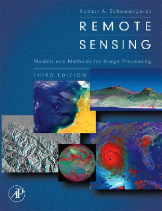
Remote Sensing
Autor Robert A Schowengerdt
Remote sensing is a technology that engages electromagnetic sensors to measure and monitor changes in the earth's surface and atmosphere. Normally this is accomplished through the use of a satellite or aircraft. This book, in its ... celý popis
- Jazyk:
 Angličtina
 - Vazba: Pevná
- Počet stran: 560
Nakladatelství: Elsevier Science Publishing Co Inc, 2006
- Více informací o knize

3232 Kč
Dostupnost:
50 % šance Máme informaci, že by titul mohl být dostupný. Na základě vaší objednávky se ho pokusíme do 6 týdnů zajistit.
Prohledáme celý svět
Mohlo by se vám také líbit
-

Urban Ecology for Citizens and Planners
1481 Kč -

Plant Physiology and Development (Paperback)
6562 Kč -

Spanish Novels: Viaje al futuro (Spanish Novels for Intermediates - B1)
290 Kč -

Conservation Biology
5060 Kč -

Flowers Amazon Forests:Margaret Mee (Hb)
1226 Kč -

One Hundred Years of U.S. Navy Air Power
1317 Kč -

Falcon
458 Kč
Darujte tuto knihu ještě dnes
- Objednejte knihu a zvolte Zaslat jako dárek.
- Obratem obdržíte darovací poukaz na knihu, který můžete ihned předat obdarovanému.
- Knihu zašleme na adresu obdarovaného, o nic se nestaráte.
Informovat o naskladnění knihy
Zadejte do formuláře e-mailovou adresu a jakmile knihu naskladníme, zašleme vám o tom zprávu. Pohlídáme vše za vás.
Více informací o knize Remote Sensing
Nákupem získáte 323 bodů
 Anotace knihy
Remote sensing is a technology that engages electromagnetic sensors to measure and monitor changes in the earth's surface and atmosphere. Normally this is accomplished through the use of a satellite or aircraft. This book, in its 3rd edition, seamlessly connects the art and science of earth remote sensing with the latest interpretative tools and techniques of computer-aided image processing. Newly expanded and updated, this edition delivers more of the applied scientific theory and practical results that helped the previous editions earn wide acclaim and become classroom and industry standards. Dr. Schowengerdt presents an advanced unified framework and rationale that uniquely empowers the reader with the latest critical thinking skills and prerequisite knowledge needed to successfully design, develop and incorporate maintainable remote sensing solutions for real-world application. Advanced remote sensing image processing techniques such as hyper spectral image analysis, fusion of multi sensor images and digital elevation model extraction from stereo imagery are discussed theoretically in terms of spectral, spatial, and geometric models. An expanded exercise section is also included at the end of each chapter allowing for the greatest level of mastery ever. This book features a new lively discussion of the NASA EOS satellites, Terra and Aqua, and the commercial satellites IKONOS and Quickbird. New larger format provides additional access to 32 PAGE - FULL COLOR plate insert and improved readability. Additional data processing algorithms help connect and enhance the collective understanding of engineering design and remotely sensed data.
 Parametry knihy
Zařazení knihy Knihy v angličtině Computing & information technology Computer science Image processing
3232 Kč
- Plný název: Remote Sensing
- Autor: Robert A Schowengerdt
- Jazyk:
 Angličtina
 - Vazba: Pevná
- Počet stran: 560
- EAN: 9780123694072
- ISBN: 0123694078
- ID: 02703614
- Nakladatelství: Elsevier Science Publishing Co Inc
- Hmotnost: 1370 g
- Rozměry: 243 × 191 × 46 mm
- Datum vydání: 28. August 2006
Oblíbené z jiného soudku
-

Computer Vision
2197 Kč -

Graph Analysis and Visualization - Discovering Business Opportunity in Linked Data
1397 Kč -

Inside PixInsight
907 Kč -

Processing
1794 Kč -

Lessons from the Masters
1387 Kč -
Digital Image Processing
2381 Kč -
Hilbert Transforms in Signal Processing
4943 Kč -

Practical OpenCV
1518 Kč -

Image Processing, Analysis, and Machine Vision, International Edition
3374 Kč -
Computer Graphics: Principles and Practice
3383 Kč -
Spotlight Synthetic Aperture Radar
5899 Kč -

Exploring GPT-3
1450 Kč -
Advanced Concepts in Image Segmentation
2018 Kč -

Deep Learning for Medical Image Analysis
3290 Kč -

Principles of Digital Image Processing
1518 Kč -
Handbook of Image Processing and Computer Vision
7708 Kč -
Digital Image Processing: Practical Approach
1665 Kč -
Principles of Digital Image Processing
1370 Kč -
Computer Vision and Image Processing
3723 Kč -
Processing of Synthetic Aperture Radar (SAR) Images
7235 Kč -

Handbook of Tractography
3285 Kč -

Introduction to Visual Computing
3190 Kč -

Image and Video Compression Standards
6296 Kč -

Advanced Color Image Processing and Analysis
5060 Kč -

Large-Scale Visual Geo-Localization
2551 Kč -

Extended Reality
1665 Kč -
Image Processing
7709 Kč -

ASIC Design for Image Processors
2941 Kč -

Geometry of Digital Spaces
1665 Kč -

Machine Learning in Medical Imaging
2404 Kč -
Unsupervised Learning in Space and Time
5255 Kč -

Engineering Applications of Acoustics
4433 Kč -

Image Restoration
3110 Kč -
Image Processing
6415 Kč -

Foundation Macromedia Dreamweaver MX 2004
817 Kč -
Single-Sensor Imaging
4284 Kč -

Video Verification in the Fake News Era
3289 Kč -

Image Processing and Communications Challenges 10
3289 Kč -

Image Processing
6100 Kč -
Lossy Image Compression
1665 Kč -
Computer Vision Applications
1665 Kč -

Proceedings of 2023 International Conference on Medical Imaging and Computer-Aided Diagnosis (MICAD 2023)
7423 Kč -

Fast, Low-resource, and Accurate Organ and Pan-cancer Segmentation in Abdomen CT
1870 Kč -

An Introduction to Signal Detection and Estimation
3723 Kč -

Integrated Spatial Databases: Digital Images and GIS
1665 Kč -
The Definitive Guide to ImageMagick
2108 Kč -
Processing
2994 Kč -
Radar Resolution and Complex-image Analysis
5567 Kč -

Simulation and Synthesis in Medical Imaging
1665 Kč
Osobní odběr Praha, Brno a 12903 dalších
Copyright ©2008-24 nejlevnejsi-knihy.cz Všechna práva vyhrazenaSoukromíCookies


 Vrácení do měsíce
 571 999 099 (8-15.30h)