Kód: 11360818
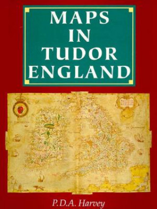
Maps in Tudor England
Autor P. D. A. Harvey, Pda Harvey
In the England of 1500 maps were rare objects, little used or understood. By 1600 they had become a familiar and practical part of everyday life, woven into tapestries, illustrating bibles, and even printed on playing cards. This ... celý popis
- Jazyk:
 Angličtina
 - Vazba: Pevná
- Počet stran: 120
Nakladatelství: Univ of Chicago Pr, 1994
- Více informací o knize

1736 Kč
Dostupnost:
50 % šance Máme informaci, že by titul mohl být dostupný. Na základě vaší objednávky se ho pokusíme do 6 týdnů zajistit.
Prohledáme celý svět
Mohlo by se vám také líbit
-

Genesis Survey: Understanding the First Book of the Bible
454 Kč -

This House Is Not for Sale
603 Kč -

Everything You Need to Know About Snakes
449 Kč -

120 Best Known Christmas Songs
494 Kč -

Big Picture Making Sense Out of Life and Religion
2384 Kč -

Second Year
2044 Kč -

Denton County
607 Kč
Darujte tuto knihu ještě dnes
- Objednejte knihu a zvolte Zaslat jako dárek.
- Obratem obdržíte darovací poukaz na knihu, který můžete ihned předat obdarovanému.
- Knihu zašleme na adresu obdarovaného, o nic se nestaráte.
Informovat o naskladnění knihy
Zadejte do formuláře e-mailovou adresu a jakmile knihu naskladníme, zašleme vám o tom zprávu. Pohlídáme vše za vás.
Více informací o knize Maps in Tudor England
Nákupem získáte 174 bodů
 Anotace knihy
In the England of 1500 maps were rare objects, little used or understood. By 1600 they had become a familiar and practical part of everyday life, woven into tapestries, illustrating bibles, and even printed on playing cards. This century witnessed the invention of the map as we understand it today - a plan drawn to a defined scale, constructed by triangulation, and describing features of the landscape with conventional signs. In Maps in Tudor England, P.D.A. Harvey traces the revolution in production, understanding, and use of maps in England from 1485 to 1603. The Tudor period witnessed an explosion of cartographic development and proliferation: only a handful of English maps are known to have been created during the second half of the fifteenth century, whereas 800 survive from the second half of the sixteenth century. By the mid-sixteenth century, mapmakers had begun to draw maps to a consistent scale and reproduced the results of measured survey. By the end of the Tudor period, maps drawn to scale that showed features by conventional signs were well established and commonly used throughout England. Harvey focuses on maps of small areas, up to the size of a county, exploring their impact on the political and social life of England, with special focus on the military, government, towns, landed estates, buildings, and the law. Superbly illustrated throughout with thirty color and fifty black and white reproductions of rare maps, this account provides an informative and accessible introduction to a revolutionary period in the history of cartography, as well as a unique visual history of Tudor England.
 Parametry knihy
1736 Kč
- Plný název: Maps in Tudor England
- Autor: P. D. A. Harvey, Pda Harvey
- Jazyk:
 Angličtina
 - Vazba: Pevná
- Počet stran: 120
- EAN: 9780226318783
- ISBN: 0226318788
- ID: 11360818
- Nakladatelství: Univ of Chicago Pr
- Hmotnost: 839 g
- Rozměry: 285 × 227 × 17 mm
- Datum vydání: February 1994
Oblíbené z jiného soudku
-

Dune
217 Kč -

Haunting Adeline
620 Kč -

Berserk Deluxe Volume 2
1092 Kč -

White Nights
93 Kč -

Powerless
260 Kč -

Atomic Habits
493 Kč -

Dune Messiah
183 Kč -

Berserk Deluxe Volume 3
1142 Kč -

One Day
218 Kč -

Berserk Deluxe Volume 1
1115 Kč -

Iron Flame
354 Kč -

Surrounded by Idiots
316 Kč -

Harry Potter and the Prisoner of Azkaban (Minalima Edition)
993 Kč -

Gravity Falls Journal 3
440 Kč -

Heaven Official's Blessing: Tian Guan Ci Fu (Novel) Vol. 1
440 Kč -

The Creative Act
426 Kč -

Dune
204 Kč -

Hunting Adeline
642 Kč -

A Little Life
267 Kč -

Children of Dune
230 Kč -

Heaven Official's Blessing: Tian Guan Ci Fu (Novel) Vol. 2
414 Kč -

Bungo Stray Dogs, Vol. 8 (light novel)
404 Kč -

Percy Jackson and the Olympians 5 Book Paperback Boxed Set
953 Kč -

Solo Leveling, Vol. 1
443 Kč -

The Prisoner's Throne
241 Kč -

Court of Thorns and Roses
254 Kč -

Cry Baby Coloring Book
249 Kč -

Fourth Wing
420 Kč -

Icebreaker
199 Kč -

Berserk Deluxe Volume 6
1089 Kč -

Avatar, the Last Airbender: The Kyoshi Novels (Box Set)
833 Kč -

The 48 Laws of Power
601 Kč -

House of Leaves
462 Kč -

Twisted Lies
213 Kč -

Dune Messiah
277 Kč -

No Longer Human
339 Kč -

48 Laws Of Power
503 Kč -

Twisted Games
276 Kč -

Caraval Paperback Boxed Set
905 Kč -

Solo Leveling, Vol. 2
479 Kč -

Open Circuits
910 Kč -

Berserk Deluxe Volume 5
1119 Kč -

Heaven Official's Blessing: Tian Guan Ci Fu (Novel) Vol. 3
441 Kč -

Berserk Deluxe Volume 4
1178 Kč -

Court of Mist and Fury
254 Kč -

SOLO LEVELING V08
436 Kč -

English File Upper Intermediate Multipack A (4th)
487 Kč -

CHAINSAW MAN V14
252 Kč -

Before the Coffee Gets Cold
276 Kč
Osobní odběr Praha, Brno a 12903 dalších
Copyright ©2008-24 nejlevnejsi-knihy.cz Všechna práva vyhrazenaSoukromíCookies


 Vrácení do měsíce
 571 999 099 (8-15.30h)