Kód: 11561478
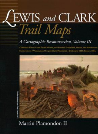
Lewis and Clark Trail Maps: Columbia River to the Pacific Ocean, and Further Columbia, Marias, and Yellowstone Explorations (Washington/Oregon/Ida
Autor Martin Plamondon
After crossing the Bitterroot Range and canoeing down the cataract-filled Snake River, the Corps of Discovery finally reached the long-sought Columbia River in the autumn of 1805. Volume III continues the cartographic reconstructi ... celý popis
- Jazyk:
 Angličtina
 - Vazba: Brožovaná
- Počet stran: 243
Nakladatelství: Washington State Univ Pr, 2004
- Více informací o knize

853 Kč
Dostupnost:
50 % šance Máme informaci, že by titul mohl být dostupný. Na základě vaší objednávky se ho pokusíme do 6 týdnů zajistit.
Prohledáme celý svět
Mohlo by se vám také líbit
-

Counseling with Confidence
853 Kč -

Mephisto
320 Kč
Dárkový poukaz: Radost zaručena
- Darujte poukaz v libovolné hodnotě a my se postaráme o zbytek.
- Poukaz se vztahuje na celou naši nabídku.
- Elektronický poukaz vytisknete z e-mailu a můžete ihned darovat.
- Platnost poukazu je 12 měsíců od data vystavení.
Informovat o naskladnění knihy
Zadejte do formuláře e-mailovou adresu a jakmile knihu naskladníme, zašleme vám o tom zprávu. Pohlídáme vše za vás.
Více informací o knize Lewis and Clark Trail Maps: Columbia River to the Pacific Ocean, and Further Columbia, Marias, and Yellowstone Explorations (Washington/Oregon/Ida
Nákupem získáte 85 bodů
 Anotace knihy
After crossing the Bitterroot Range and canoeing down the cataract-filled Snake River, the Corps of Discovery finally reached the long-sought Columbia River in the autumn of 1805. Volume III continues the cartographic reconstruction of the explorers' trek as they set out from the Snake-Columbia junction, October 18, 1805, on the final leg of their journey to the sea. In addition to intricately mapping the Columbia's great rapids, desert and rain-forest shorelines, spectacular mountain gorge, and broad estuary, Volume III reveals the vast number of Native American villages that lined the River of the West in Lewis and Clark's time. Additional maps and illustrations depict the Fort Clatsop winter quarters, Cascade volcanoes, coastal explorations, and more. Though having reached their primary goal, the Pacific Ocean, the expedition's investigation of new terrain in western North America was far from over. Volume III also outlines the significant discoveries recorded as they returned eastward in 1806 through the broad Columbia, Marias, and Yellowstone watersheds. Volume III concludes when the Corps of Discovery, long given up for dead by most Americans, paddled up to the St. Louis waterfront on September 23, 1806, to an arousing reception by the local population. During the Corps of Discovery's 1804-06 trek, Captain William Clark used surveying instruments to measure the expedition's traverse to the Pacific Ocean and back--an astounding distance of 7,000 miles. Clark assumed that cartographers would convert this painstakingly recorded daily traverse on to well-crafted, accurate maps soon after the journey's completion. For various reasons, this did not occur. For nearly two centuries,Clark's invaluable survey data remained untapped in the expedition's annals. Now, Martin Plamondon II has completed the cartographic reconstruction that Clark expected by utilizing the day-to-day measurements and notes, the maps and sketches, and other pertinent information in t
 Parametry knihy
853 Kč
- Plný název: Lewis and Clark Trail Maps: Columbia River to the Pacific Ocean, and Further Columbia, Marias, and Yellowstone Explorations (Washington/Oregon/Ida
- Autor: Martin Plamondon
- Jazyk:
 Angličtina
 - Vazba: Brožovaná
- Počet stran: 243
- EAN: 9780874222678
- ISBN: 0874222672
- ID: 11561478
- Nakladatelství: Washington State Univ Pr
- Hmotnost: 1080 g
- Rozměry: 297 × 239 × 21 mm
- Datum vydání: May 2004
Oblíbené z jiného soudku
-

Dune
216 Kč -

Haunting Adeline
621 Kč -

Berserk Deluxe Volume 2
1092 Kč -

White Nights
89 Kč -

Powerless
268 Kč -

Atomic Habits
330 Kč -

Dune Messiah
228 Kč -

Berserk Deluxe Volume 3
1142 Kč -

One Day
221 Kč -

Berserk Deluxe Volume 1
1115 Kč -

Iron Flame
368 Kč -

Surrounded by Idiots
213 Kč -

Harry Potter and the Prisoner of Azkaban (Minalima Edition)
993 Kč -

Gravity Falls Journal 3
443 Kč -

Heaven Official's Blessing: Tian Guan Ci Fu (Novel) Vol. 1
420 Kč -

The Creative Act
568 Kč -
Dune
276 Kč -

Hunting Adeline
624 Kč -

A Little Life
290 Kč -

Children of Dune
230 Kč -

Heaven Official's Blessing: Tian Guan Ci Fu (Novel) Vol. 2
427 Kč -

Bungo Stray Dogs, Vol. 8 (light novel)
383 Kč -

Percy Jackson and the Olympians 5 Book Paperback Boxed Set
944 Kč -

Solo Leveling, Vol. 1
440 Kč -

The Prisoner's Throne
247 Kč -

Court of Thorns and Roses
268 Kč -

Cry Baby Coloring Book
276 Kč -

Fourth Wing
407 Kč -

Icebreaker
199 Kč -

Berserk Deluxe Volume 6
1089 Kč -

Avatar, the Last Airbender: The Kyoshi Novels (Box Set)
986 Kč -

The 48 Laws of Power
601 Kč -

House of Leaves
611 Kč -

Twisted Lies
213 Kč -

Dune Messiah
272 Kč -

No Longer Human
359 Kč -

48 Laws Of Power
331 Kč -

Twisted Games
213 Kč -

Caraval Paperback Boxed Set
902 Kč -

Solo Leveling, Vol. 2
468 Kč -

Open Circuits
907 Kč -

Berserk Deluxe Volume 5
1119 Kč -

Heaven Official's Blessing: Tian Guan Ci Fu (Novel) Vol. 3
476 Kč -

Berserk Deluxe Volume 4
1125 Kč -

Court of Mist and Fury
206 Kč -

SOLO LEVELING V08
436 Kč -

English File Upper Intermediate Multipack A (4th)
531 Kč -

CHAINSAW MAN V14
254 Kč -

Before the Coffee Gets Cold
184 Kč
Osobní odběr Praha, Brno a 12903 dalších
Copyright ©2008-24 nejlevnejsi-knihy.cz Všechna práva vyhrazenaSoukromíCookies


 Vrácení do měsíce
 571 999 099 (8-15.30h)