Kód: 04887411
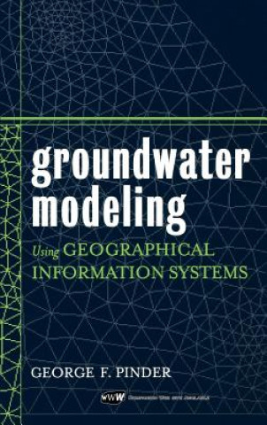
Groundwater Modeling Using Geographical Information Systems
Autor George F. Pinder
Cutting-edge techniques for groundwater modeling using GIS technology Groundwater Modeling Using Geographical Information Systems covers fundamental information on flow and mass transport modeling and demonstrates how GIS technolo ... celý popis
- Jazyk:
 Angličtina
 - Vazba: Pevná
- Počet stran: 248
Nakladatelství: John Wiley & Sons Inc, 2002
- Více informací o knize

Mohlo by se vám také líbit
-

Overlord, Vol. 8 (Light Novel)
409 Kč -

Transient Light Tarot
625 Kč -

Poirot Investigates (Deluxe Library Binding)
870 Kč -

Not Here To Be Liked
254 Kč -

People From My Neighbourhood
276 Kč -

Doctor Who: Dalek
473 Kč -

Practice Makes Perfect: Complete Italian Grammar, Premium Third Edition
553 Kč -

Book of Tea
266 Kč -

NEW Worst-Case Scenario Survival Handbook
445 Kč -

Country House: Past, Present, Future
1658 Kč -

Selected Works of Edgar Allan Poe
223 Kč -

Violent and Painful Anal Sex: Five tales of brutal and degrading sodomy
298 Kč -

Modern Crochet Mandalas
749 Kč -

Moby-Dick
358 Kč -

Information Extraction
2396 Kč -

Saxo Grammaticus: The History of the Danes, Books I-IX
1193 Kč -

21st Century Journalism in India
1135 Kč -

Basic Polish
1752 Kč -

Lord of the Rings
1879 Kč -

Midnight Rose
273 Kč -

Deathless
286 Kč
Dárkový poukaz: Radost zaručena
- Darujte poukaz v libovolné hodnotě a my se postaráme o zbytek.
- Poukaz se vztahuje na celou naši nabídku.
- Elektronický poukaz vytisknete z e-mailu a můžete ihned darovat.
- Platnost poukazu je 12 měsíců od data vystavení.
Více informací o knize Groundwater Modeling Using Geographical Information Systems
Nákupem získáte 425 bodů
 Anotace knihy
Cutting-edge techniques for groundwater modeling using GIS technology Groundwater Modeling Using Geographical Information Systems covers fundamental information on flow and mass transport modeling and demonstrates how GIS technology makes these models and analyses more accurate than ever before. GIS technology allows for swift organization, quantification, and interpretation of large quantities of geohydrological data with computer accuracy and minimal risk of human error. This book's companion Web site provides the Princeton Transport Code, as well as the plug-in extensions required to interface this code with the Argus ONE numerical environment software enclosed with this book. Plug-in extensions for MODFLOW and MT3D computer codes can be found at the Argus ONE Web site (www.argusint.com). The process for using the Geographic Modeling Approach (GMA) to model groundwater flow and transport is demonstrated step by step with a field example from Tucson, Arizona. The GMA is composed of the Argus ONE Geographic Information Modeling system and the Princeton Transport Code groundwater flow and transport model, interfaced through the plug-in extension available on Argus ONE. Enhanced with more than 150 illustrations and screen captures, Groundwater Modeling Using Geographical Information Systems is a fundamental book for civil engineers, hydrologists, environmental engineers, geologists, and students in these fields, as well as software engineers working on GIS applications and environmental attorneys and regulators. When used in combination with the free modeling software, this book provides an excellent student text.
 Parametry knihy
Zařazení knihy Knihy v angličtině Earth sciences, geography, environment, planning Earth sciences Hydrology & the hydrosphere
4251 Kč
- Plný název: Groundwater Modeling Using Geographical Information Systems
- Autor: George F. Pinder
- Jazyk:
 Angličtina
 - Vazba: Pevná
- Počet stran: 248
- EAN: 9780471084983
- ISBN: 0471084980
- ID: 04887411
- Nakladatelství: John Wiley & Sons Inc
- Hmotnost: 538 g
- Rozměry: 241 × 163 × 19 mm
- Datum vydání: 24. July 2002
Oblíbené z jiného soudku
-

Oceanology
1102 Kč -

Oceans of Kansas, Second Edition
996 Kč -

Ocean Animals Sticker Activity Book
155 Kč -

Attacking Ocean
615 Kč -

Hydrological Drought
5225 Kč -

Lakes: A Very Short Introduction
269 Kč -

Under the Sea-Wind
380 Kč -

Rainfall-Runoff Modelling - The Primer 2e
2779 Kč -

Oceans: A Very Short Introduction
249 Kč -

World Is Blue
385 Kč -

Middle Sea
410 Kč -

Water Wizard
704 Kč -

Log from the Sea of Cortez
465 Kč -

Groundwater Hydrology
2547 Kč -

Our Changing Planet
1519 Kč -

Industrial Wastewater Treatment
5094 Kč -

Oceans
756 Kč -

Alien Ocean
1053 Kč -

Rainwater Harvesting-Building a Water Smart City
4798 Kč -

Ocean Worlds
344 Kč -

Essentials of Oceanography
3056 Kč -

Atlantic
410 Kč -

Water Resources in Slovakia: Part II
8953 Kč -

Atchafalaya River Basin
945 Kč -

Principles of Snow Hydrology
1704 Kč -

Water
516 Kč -

Applied Hydrogeology
2479 Kč -

Advanced Dam Engineering for Design, Construction, and Rehabilitation
6578 Kč -

Fluvial Processes in Geomorphology: Seco
901 Kč -

Geology for Geotechnical Engineers
1402 Kč -

Gravel-Bed Rivers - Processes and Disasters
6169 Kč -

Water Treatment for Purification from Cyanobacteria and Cyanotoxins
4917 Kč -

Tracers in Hydrology
3213 Kč -

Tsunamis
282 Kč -

Ocean Surface Waves: Their Physics And Prediction (2nd Edition)
2699 Kč -

Mapping the Deep
628 Kč -

Encyclopedia of Water
36370 Kč -

Rivers: A Very Short Introduction
282 Kč -

Introduction to Physical Oceanography
3611 Kč -

Sea is Not Made of Water
474 Kč -

Design of Hydraulic Gates
9582 Kč -

Sea Ice Biota
7095 Kč -

Book of Tides
765 Kč -

Advanced Treatment Technologies for Fluoride Removal in Water
4798 Kč -

Essentials of Oceanography
4973 Kč -

The Danube River Delta
3313 Kč -

Offshore Structures
3017 Kč -

Satellite Sar Detection Of Sub-mesoscale Ocean Dynamic Processes
4207 Kč -

Limnology and Freshwater Ecology
3851 Kč
Osobní odběr Praha, Brno a 12903 dalších
Copyright ©2008-24 nejlevnejsi-knihy.cz Všechna práva vyhrazenaSoukromíCookies


 Vrácení do měsíce
 571 999 099 (8-15.30h)