Kód: 04611140
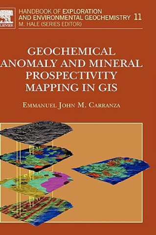
Geochemical Anomaly and Mineral Prospectivity Mapping in GIS
Autor E.J.M. Carranza
The book documents and explains, in three parts, geochemical anomaly and mineral prospectivity mapping by using a geographic information system (GIS). Part I reviews and couples the concepts of (a) mapping geochemical anomalies an ... celý popis
- Jazyk:
 Angličtina
 - Vazba: Pevná
- Počet stran: 368
Nakladatelství: Elsevier Science & Technology, 2008
- Více informací o knize

Mohlo by se vám také líbit
-

Golfer's Mind
249 Kč -

Grandparent's Keepsake Album
473 Kč
Darujte tuto knihu ještě dnes
- Objednejte knihu a zvolte Zaslat jako dárek.
- Obratem obdržíte darovací poukaz na knihu, který můžete ihned předat obdarovanému.
- Knihu zašleme na adresu obdarovaného, o nic se nestaráte.
Více informací o knize Geochemical Anomaly and Mineral Prospectivity Mapping in GIS
Nákupem získáte 543 bodů
 Anotace knihy
The book documents and explains, in three parts, geochemical anomaly and mineral prospectivity mapping by using a geographic information system (GIS). Part I reviews and couples the concepts of (a) mapping geochemical anomalies and mineral prospectivity and (b) spatial data models, management and operations in a GIS. Part II demonstrates GIS-aided and GIS-based techniques for analysis of robust thresholds in mapping of geochemical anomalies. Part III explains GIS-aided and GIS-based techniques for spatial data analysis and geo-information sybthesis for conceptual and predictive modeling of mineral prospectivity. Because methods of geochemical anomaly mapping and mineral potential mapping are highly specialized yet diverse, the book explains only methods in which GIS plays an important role. The book avoids using language and functional organization of particular commercial GIS software, but explains, where necessary, GIS functionality and spatial data structures appropriate to problems in geochemical anomaly mapping and mineral potential mapping. Because GIS-based methods of spatial data analysis and spatial data integration are quantitative, which can be complicated to non-numerate readers, the book simplifies explanations of mathematical concepts and their applications so that the methods demonstrated would be useful to professional geoscientists, to mineral explorationists and to research students in fields that involve analysis and integration of maps or spatial datasets. The book provides adequate illustrations for more thorough explanation of the various concepts. *Explains GIS functionality and spatial data structures appropriate regardless of the particular GIS software in use *Simplifies explanation of mathematical concepts and application *Illustrated for more thorough explanation of concepts
 Parametry knihy
Zařazení knihy Knihy v angličtině Earth sciences, geography, environment, planning Earth sciences
5429 Kč
- Plný název: Geochemical Anomaly and Mineral Prospectivity Mapping in GIS
- Autor: E.J.M. Carranza
- Jazyk:
 Angličtina
 - Vazba: Pevná
- Počet stran: 368
- EAN: 9780444513250
- ISBN: 0444513256
- ID: 04611140
- Nakladatelství: Elsevier Science & Technology
- Hmotnost: 710 g
- Rozměry: 166 × 242 × 23 mm
- Datum vydání: 26. November 2008
Oblíbené z jiného soudku
-

Cowen's History of Life 6e
2443 Kč -

Nature of Nature
548 Kč -

Science of the Earth
793 Kč -

Information
484 Kč -

Earth System History
2640 Kč -
Mesoscale Meteorology in Midlatitudes
2306 Kč -

Terraforming Mars
6528 Kč -

ISE Physical Geology
1874 Kč -
Geotechnical Instrumentation and Applications
2643 Kč -

Geoscience for Petroleum Engineers
3060 Kč -

Cold breath of sleeping volcanoes
702 Kč -

Introduction to Paleobiology and the Fossil Record , 2nd Edition
1799 Kč -

Mastering ArchiMate - Edition II
2198 Kč -

Quaternary Dating Methods
2950 Kč -

Earth System Science: A Very Short Introduction
269 Kč -

Nature Illuminated
422 Kč -

Ecology and Management of Forest Soils 5e
3568 Kč -

Earth History and Palaeogeography
2512 Kč -
Geochemistry, Second Edition
3079 Kč -

Computational Fairy Tales
355 Kč -

Fundamental Planetary Science
1880 Kč -

Bohdalec
1593 Kč -

New Trends in Earth-Science Outreach and Engagement
3313 Kč -

Hunterian Lectures in Comparative Anatomy, May & June 1837 (Cloth)
3050 Kč -

Quaternary Dating Methods
2922 Kč -

TOGAF Version 9
3449 Kč -
Climatic Change at High Elevation Sites
5094 Kč -

Mineralogy of Quartz and Silica Minerals
1759 Kč -

Sailing Directory for the Baltic, Comprising a General Description of the Bays, Harbours, Islands, Included Between the Sound and the Gulf of Finland.
559 Kč -

Mutual Evolution of Earth and Humanity
1520 Kč -

Language of the Earth 2e
1460 Kč -
Python Recipes for Earth Sciences
2259 Kč -

Art of Business Process Modeling
301 Kč -

Handbook of Archaeological Sciences
4376 Kč -

Blue Planet - An Introduction to Earth System Science 3e
5670 Kč -

Earth Science, Global Edition
3089 Kč -

Geology and Mineralogy of Gemstones
3476 Kč -

Geological and Mud Logging in Drilling Control
1681 Kč -

Crystallography
3017 Kč -

Red Sea
3422 Kč -

Lop Nor China
3562 Kč -

In Six Days
411 Kč -
![Crystallography for Beginners. with an Appendix on the Use of the Blowpipe and the Determination of Common Minerals, Etc. [With 3 Tables of Diagrams.] Crystallography for Beginners. with an Appendix on the Use of the Blowpipe and the Determination of Common Minerals, Etc. [With 3 Tables of Diagrams.]](https://media.libris.to/jacket/07986811t.jpg)
Crystallography for Beginners. with an Appendix on the Use of the Blowpipe and the Determination of Common Minerals, Etc. [With 3 Tables of Diagrams.]
562 Kč -

Viticulture and Winemaking under Climate Change
1759 Kč -

Oceans For Dummies
625 Kč -

Principles of Engineering Management
6578 Kč -
Synthetic Aperture Radar (SAR) Techniques and Applications
1961 Kč -

Conservation of Architectural Heritage
6578 Kč -

ISE The Good Earth: Introduction to Earth Science
2272 Kč
Osobní odběr Praha, Brno a 12903 dalších
Copyright ©2008-24 nejlevnejsi-knihy.cz Všechna práva vyhrazenaSoukromíCookies


 Vrácení do měsíce
 571 999 099 (8-15.30h)