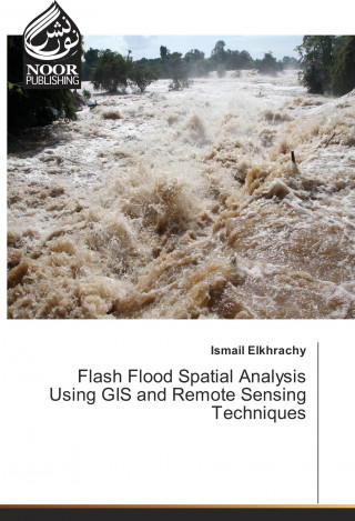
Kód: 16268994
Flash Flood Spatial Analysis Using GIS and Remote Sensing Techniques
Autor Ismail Elkhrachy
The "Flash Flood Spatial Analysis Using GIS and Remote Sensing Techniques" is a readable text that presents basic concepts and practical material in each of the areas remote sensing and Geographic information system. It is written ... celý popis
- Jazyk:
 Angličtina
 - Vazba: Brožovaná
- Počet stran: 72
Nakladatelství: Noor Publishing, 2017
- Více informací o knize

Mohlo by se vám také líbit
-

Manx Miscellany
310 Kč -

Cords of Harmony
1260 Kč -

Massachusetts civil List for the colonial and provincial Periods
645 Kč -

An Angel From Above
434 Kč -

Clan Green Bear: Wizards of White Haven
530 Kč -

Moving Pictures
429 Kč -

Entre gargantas
318 Kč
Dárkový poukaz: Radost zaručena
- Darujte poukaz v libovolné hodnotě a my se postaráme o zbytek.
- Poukaz se vztahuje na celou naši nabídku.
- Elektronický poukaz vytisknete z e-mailu a můžete ihned darovat.
- Platnost poukazu je 12 měsíců od data vystavení.
Více informací o knize Flash Flood Spatial Analysis Using GIS and Remote Sensing Techniques
Nákupem získáte 91 bodů
 Anotace knihy
The "Flash Flood Spatial Analysis Using GIS and Remote Sensing Techniques" is a readable text that presents basic concepts and practical material in each of the areas remote sensing and Geographic information system. It is written primarily for students and researchers who are interested in studying flash flood using satellite images. The book contains a case study in Najran city, KSA. Although the book has descriptions of some software such as ArcGIS and Hec-Ras which are used to get water surface during any flash flood event. Moreover, it contains how to use SAR images to calibrate obtained results from Hydrology investigations.
 Parametry knihy
908 Kč
- Plný název: Flash Flood Spatial Analysis Using GIS and Remote Sensing Techniques
- Autor: Ismail Elkhrachy
- Jazyk:
 Angličtina
 - Vazba: Brožovaná
- Počet stran: 72
- EAN: 9783330853393
- ISBN: 3330853395
- ID: 16268994
- Nakladatelství: Noor Publishing
- Hmotnost: 124 g
- Rozměry: 220 × 150 × 4 mm
- Datum vydání: 29. April 2017
Oblíbené z jiného soudku
-

Dune
262 Kč -

Haunting Adeline
617 Kč -

Berserk Deluxe Volume 2
1050 Kč -

White Nights
90 Kč -

Powerless
259 Kč -

Atomic Habits
340 Kč -

Dune Messiah
178 Kč -

Berserk Deluxe Volume 3
1138 Kč -

One Day
276 Kč -

Berserk Deluxe Volume 1
1033 Kč -

Iron Flame
353 Kč -

Surrounded by Idiots
256 Kč -

Harry Potter and the Prisoner of Azkaban (Minalima Edition)
688 Kč -

Gravity Falls Journal 3
440 Kč -

Heaven Official's Blessing: Tian Guan Ci Fu (Novel) Vol. 1
426 Kč -

The Creative Act
540 Kč -

Dune
214 Kč -

Hunting Adeline
633 Kč -

A Little Life
259 Kč -

Children of Dune
174 Kč -

Heaven Official's Blessing: Tian Guan Ci Fu (Novel) Vol. 2
441 Kč -

Bungo Stray Dogs, Vol. 8 (light novel)
368 Kč -

Percy Jackson and the Olympians 5 Book Paperback Boxed Set
953 Kč -

Solo Leveling, Vol. 1
445 Kč -

The Prisoner's Throne
238 Kč -

Court of Thorns and Roses
254 Kč -

Cry Baby Coloring Book
256 Kč -

Fourth Wing
351 Kč -

Icebreaker
200 Kč -

Berserk Deluxe Volume 6
1086 Kč -

Avatar, the Last Airbender: The Kyoshi Novels (Box Set)
676 Kč -

The 48 Laws of Power
530 Kč -

House of Leaves
405 Kč -

Twisted Lies
276 Kč -

Dune Messiah
220 Kč -

No Longer Human
340 Kč -

48 Laws Of Power
471 Kč -

Twisted Games
214 Kč -

Caraval Paperback Boxed Set
906 Kč -

Solo Leveling, Vol. 2
448 Kč -

Open Circuits
861 Kč -

Berserk Deluxe Volume 5
1115 Kč -

Heaven Official's Blessing: Tian Guan Ci Fu (Novel) Vol. 3
410 Kč -

Berserk Deluxe Volume 4
1165 Kč -

Court of Mist and Fury
221 Kč -

SOLO LEVELING V08
450 Kč -

English File Upper Intermediate Multipack A (4th)
495 Kč -

CHAINSAW MAN V14
250 Kč -

Before the Coffee Gets Cold
191 Kč
Osobní odběr Praha, Brno a 12903 dalších
Copyright ©2008-24 nejlevnejsi-knihy.cz Všechna práva vyhrazenaSoukromíCookies


 Vrácení do měsíce
 571 999 099 (8-15.30h)