Kód: 05055631
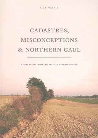
Cadastres, Misconceptions and Northern Gaul
Autor Rick Bonnie
A Roman cadastre is a particular form of land allotment which looks like a chequerboard. It was implemented by the Romans in regions throughout the Empire, from Syria to Gaul. Yet, how did a Roman cadastre exactly look like? What ... celý popis
- Jazyk:
 Angličtina
 - Vazba: Brožovaná
- Počet stran: 169
Nakladatelství: Sidestone Press, 2009
- Více informací o knize

1476 Kč
Dostupnost:
50 % šance Máme informaci, že by titul mohl být dostupný. Na základě vaší objednávky se ho pokusíme do 6 týdnů zajistit.
Prohledáme celý svět
Mohlo by se vám také líbit
-

Shakespeare, Milton and Eighteenth-Century Literary Editing
3101 Kč -

Complots et cabales
358 Kč -

Closer - 52 Devotions to Draw Couples Together
414 Kč -

Parables For Preachers
617 Kč -

Greeks, Latins, and the Church in Early Frankish Cyprus
1559 Kč -

Bluebonnet at the Marshall Train Depot
498 Kč -

Dennis Oppenheim
620 Kč
Dárkový poukaz: Radost zaručena
- Darujte poukaz v libovolné hodnotě a my se postaráme o zbytek.
- Poukaz se vztahuje na celou naši nabídku.
- Elektronický poukaz vytisknete z e-mailu a můžete ihned darovat.
- Platnost poukazu je 12 měsíců od data vystavení.
Informovat o naskladnění knihy
Zadejte do formuláře e-mailovou adresu a jakmile knihu naskladníme, zašleme vám o tom zprávu. Pohlídáme vše za vás.
Více informací o knize Cadastres, Misconceptions and Northern Gaul
Nákupem získáte 148 bodů
 Anotace knihy
A Roman cadastre is a particular form of land allotment which looks like a chequerboard. It was implemented by the Romans in regions throughout the Empire, from Syria to Gaul. Yet, how did a Roman cadastre exactly look like? What has Roman cadastration in common with centuriatio and parcellation, and what not? Are aerial photographs and maps a reliable source to reveal traces of a Roman cadastre? Did Roman cadastres exist outside the Mediterranean region, and if so, what are the consequences of its existence on a socio-cultural level? Behind these apparently straightforward questions are for most scholars simple definitive answers. On the basis of these answers scholars have regarded the archaeological study of Roman cadastres often as optimistic, biased and even unscientific. In Cadastres, Misconceptions and Northern Gaul Rick Bonnie argues that during the Middle-Roman period a cadastre was implemented by the Romans around the provincial Roman city of Tongres. In contrast to general beliefs, Bonnie demonstrates that it is possible, using aerial photographs and maps, to reconstruct a landscape outside the Mediterranean region that was overlain by a Roman cadastre. It furthermore discusses and examines the history of research, historical and archaeological sources on Roman cadastres, as well as the Roman period of the Belgian Hesbaye region. Rick Bonnie studied Classical Archaeology at Leiden University (MA cum laude 2008). His thesis was awarded the W. A. van Es-prize by the Dutch Institute for Cultural Heritage and was nominated for the Leiden University thesis prize 2007-2008.
 Parametry knihy
Zařazení knihy Knihy v angličtině Humanities Archaeology Archaeology by period / region
1476 Kč
- Plný název: Cadastres, Misconceptions and Northern Gaul
- Autor: Rick Bonnie
- Jazyk:
 Angličtina
 - Vazba: Brožovaná
- Počet stran: 169
- EAN: 9789088900242
- ISBN: 9088900248
- ID: 05055631
- Nakladatelství: Sidestone Press
- Hmotnost: 499 g
- Rozměry: 292 × 206 × 10 mm
- Datum vydání: 01. December 2009
Oblíbené z jiného soudku
-

Lifeways of Hunter-Gatherers
855 Kč -

Lost Technologies of Ancient Egypt
518 Kč -

Magicians of the Gods
378 Kč -
Egyptian Hieroglyphs for Complete Beginners
356 Kč -
Horse, the Wheel, and Language
770 Kč -

War before Civilization
689 Kč -
Petra
222 Kč -

Cat in Ancient Egypt
302 Kč -
Complete Pompeii
543 Kč -
Human Past
1657 Kč -

Scenes from Prehistoric Life
677 Kč -

Across Atlantic Ice
1076 Kč -

Book of Enoch
933 Kč -

Timewalkers
507 Kč -

Creating the Human Past
585 Kč -
Mesolithic Europe
3414 Kč -
Resurfacing the Submerged Past
1840 Kč -

American Beginnings
2119 Kč -
Stone Age Prehistory
806 Kč -

Her Cup for Sweet Cacao
1666 Kč -

Lindow Man
192 Kč -

Against the Grain
476 Kč -

Dress Accessories, c. 1150- c. 1450
898 Kč -
Rise of Bronze Age Society
2003 Kč -
Lewis Chessmen: Unmasked
247 Kč -
Neanderthals Among Mammoths
5180 Kč -

Biblical Archaeology: A Very Short Introduction
249 Kč -
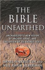
Bible Unearthed
423 Kč -

Seismosaurus
2755 Kč -
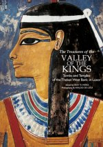
Treasures of the Valley of the Kings
725 Kč -
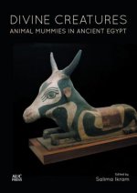
Divine Creatures
660 Kč -

Tutankhamun
810 Kč -
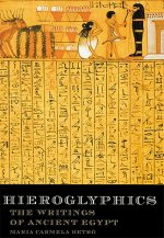
Hieroglyphics
738 Kč -
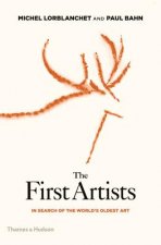
First Artists
542 Kč -
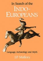
In Search of the Indo-Europeans
851 Kč -

Performance Power and the Art of the Aegean Bronze Age
1451 Kč -

Tasting the Past
673 Kč -
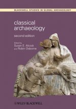
Classical Archaeology 2e
1076 Kč -

Upper Pleistocene Prehistory of Western Eurasia
2107 Kč -

Humans at the End of the Ice Age
5060 Kč -
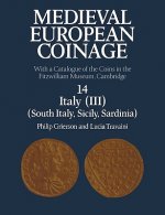
Medieval European Coinage: Volume 14, South Italy, Sicily, Sardinia
2184 Kč -

Prehistory: A Very Short Introduction
273 Kč -
Mochlos IB
2808 Kč -

Salt in Prehistoric Europe
929 Kč -

Prehistoric Rock Art
1085 Kč -

Medieval Household
1116 Kč -
Complete Cities of Ancient Egypt
763 Kč -

First Signs
329 Kč -
Mesolithic Europe
1783 Kč
Osobní odběr Praha, Brno a 12903 dalších
Copyright ©2008-24 nejlevnejsi-knihy.cz Všechna práva vyhrazenaSoukromíCookies


 Vrácení do měsíce
 571 999 099 (8-15.30h)