Kód: 04096625
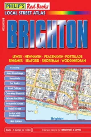
Philip's Red Books Brighton
This local street atlas of Brighton and its surrounding towns and villages gives detailed coverage of the area at a scale of 4 inches to 1 mile. It also includes enlarged centre maps for Brighton (at 8 inches to 1 mile) and Lewes ... celý popis
- Jazyk:
 Angličtina
 - Vazba: Brožovaná
- Počet stran: 48
Nakladatelství: PHILIP´S, 2008
- Více informací o knize

Mohlo by se vám také líbit
-

Brighton 1909
121 Kč
Informovat o naskladnění knihy
Zadejte do formuláře e-mailovou adresu a jakmile knihu naskladníme, zašleme vám o tom zprávu. Pohlídáme vše za vás.
Více informací o knize Philip's Red Books Brighton
 Anotace knihy
This local street atlas of Brighton and its surrounding towns and villages gives detailed coverage of the area at a scale of 4 inches to 1 mile. It also includes enlarged centre maps for Brighton (at 8 inches to 1 mile) and Lewes (at 6 inches to 1 mile).The maps show hospitals, car parks, post offices, one-way streets, leisure facilities, industrial areas and retail areas, while the index lists street names and postcodes. An area road map enables the user to identify through-routes more easily.Pocket sized, and wire stitched so that it opens out flat, the atlas is ideally suited for both business and leisure use, whether by locals or visitors.
 Parametry knihy
Zařazení knihy Knihy v angličtině Lifestyle, sport & leisure Travel & holiday Places & peoples: general & pictorial works
- Plný název: Philip's Red Books Brighton
- Jazyk:
 Angličtina
 - Vazba: Brožovaná
- Počet stran: 48
- EAN: 9780540093809
- ID: 04096625
- Nakladatelství: PHILIP´S
- Hmotnost: 82 g
- Rozměry: 202 × 138 × 8 mm
- Datum vydání: 28. March 2008
Oblíbené z jiného soudku
-

Metropolis (ENG/GER)
1981 Kč -

New York Street Diaries
1403 Kč -

Matterhorn
602 Kč -

Lonely Planet Epic Bike Rides of the World
416 Kč -

Find Momo Coast to Coast
378 Kč -

Lonely Planet's Ultimate Travel List 2
518 Kč -

New England Indians
366 Kč -

Alex Webb: Istanbul
1516 Kč -

Trieste
302 Kč -

Skandinavien - Der Zauber des hohen Nordens - Wochenplaner Kalender 2024
518 Kč -

Rome: Panorama Pops
196 Kč -

1,000 Places to See Before You Die
577 Kč -

Lonely Planet Epic Surf Breaks of the World
677 Kč -

Tokyo Unseen
542 Kč -

The Most Beautiful Villages of Tuscany
408 Kč -

Lonely Planet Epic Runs of the World
677 Kč -

My Dad Had That Car
803 Kč -

Iconic New York
1170 Kč -

Lonely Planet National Parks of America
543 Kč -

Lost Japan
261 Kč -

Scotland in Photographs
490 Kč -

Best Loved Villages of France
610 Kč -

Last Resort
1013 Kč -

Icons of England
302 Kč -

Seasons of New York
462 Kč -

Alaska
920 Kč -

Provence Sketchbook
810 Kč -

Berchtesgaden and its Attractions
348 Kč -

Dark Skies
431 Kč -

Lonely Planet How to Survive Anything
431 Kč -

Lonely Planet Lonely Planet's Guide to Life
613 Kč -

Lodestars Anthology
1029 Kč -

I Never Knew That About Ireland
410 Kč -

KUNTH Unterwegs auf allen Meeren
922 Kč -

Travel Book
2071 Kč -

Hebrides
677 Kč -

Lonely Planet The Travel Book
648 Kč -

Paris Magnum
1218 Kč -

Michael Kenna: Forms of Japan
2145 Kč -

How to be Danish: From Lego to Lund ... a Short Introduction to the State of Denmark
356 Kč -

Bigger Book of Everything
431 Kč -

150 Houses You Need to Visit Before You Die
811 Kč -

Italian Dream: Wine, Heritage, Soul
3539 Kč -

Lonely Planet The Cities Book
1015 Kč -

Hungry Planet
617 Kč -

See San Francisco
463 Kč -

New York: A Photographic Album
280 Kč -

Most Beautiful Villages of Provence
408 Kč -
Rome Sketchbook
1412 Kč
Osobní odběr Praha, Brno a 12903 dalších
Copyright ©2008-24 nejlevnejsi-knihy.cz Všechna práva vyhrazenaSoukromíCookies


 Vrácení do měsíce
 571 999 099 (8-15.30h)