Kód: 04201557
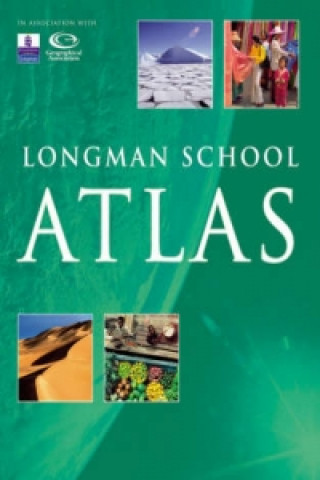
Longman School Atlas
Autor Stephen Scoffham
But what makes these Atlases so different from the rest? * They're exciting and informative -- With amazing photos, interesting discussion points and statistics integrated around EVERY map to draw your pupils in, these are Atlases ... celý popis
- Jazyk:
 Angličtina
 - Vazba: Brožovaná
- Počet stran: 112
Nakladatelství: PEARSON Education Limited, 2006
- Více informací o knize

Mohlo by se vám také líbit
-

CHILDREN'S PICTURE DICTIONARY TEACHER'S RESOURCE 005316
932 Kč -
Maps Activity Book
278 Kč -

Key Words: 2a We have fun
89 Kč -

100's of the Coolest, Fastest
115 Kč -

London Activity Book
282 Kč -

World Atlas
407 Kč -

Longman Pocket Phrasal Verbs Dictionary Cased
548 Kč -
Longman Phrasal Verbs Dictionary Paper
796 Kč -

Oxford School Atlas
329 Kč -
Maps
706 Kč -

Longman Dictionary of Language Teaching and Applied Linguistics
1881 Kč -

Intellectual Commons
3776 Kč -

Saunders Solutions in Veterinary Practice: Small Animal Dentistry
1967 Kč -

Oxford Primary Atlas
418 Kč
Informovat o naskladnění knihy
Zadejte do formuláře e-mailovou adresu a jakmile knihu naskladníme, zašleme vám o tom zprávu. Pohlídáme vše za vás.
Více informací o knize Longman School Atlas
 Anotace knihy
But what makes these Atlases so different from the rest? * They're exciting and informative -- With amazing photos, interesting discussion points and statistics integrated around EVERY map to draw your pupils in, these are Atlases you and your pupils will want to use again and again.*Content that's tailored to match the Curriculum -- Thanks to the Geographical Association, who understand what you need from an atlas in the classroom, you can be sure that these Atlases have exactly what you need to support Key Stage 3 and Key Stage 4 learning.*Design that's tailored to meet the needs of your pupils -- Dorling Kindersley designers and the Geographical Association worked closely together to ensure the design makes these Atlases the most accessible and easiest to use.*They're created by people you know and trust -- the Atlases incorporate the subject expertise of the Geographical Association, with the stunning visuals of Dorling Kindersley and the curriculum understanding of Longman to give you Atlases of the highest quality. Longman School Atlas * Introduces key themes of interdependence, environment, globalisation, change and development -- including a chapter dedicated to development issues.*"Earth from the sky" sections provide satellite images and aerial photographs for every continent, giving pupils the opportunity to use a variety of secondary sources.*A map skills section gives clear guidance on how to use the atlas.
 Parametry knihy
Zařazení knihy Knihy v angličtině Children's, Teenage & educational Reference material (Children's / Teenage) Atlases & maps (Children’s/Teenage)
- Plný název: Longman School Atlas
- Autor: Stephen Scoffham
- Jazyk:
 Angličtina
 - Vazba: Brožovaná
- Počet stran: 112
- EAN: 9781405822640
- ISBN: 1405822643
- ID: 04201557
- Nakladatelství: PEARSON Education Limited
- Hmotnost: 380 g
- Rozměry: 290 × 230 × 10 mm
- Datum vydání: 31. May 2006
Oblíbené z jiného soudku
-

Big Book of the UK
410 Kč -

50 States
545 Kč -

Big Picture Atlas
410 Kč -
National Geographic Kids U.S. Atlas 2020
340 Kč -
Maps Poster Book
356 Kč -
Philip's Modern School Atlas
495 Kč -
Children's Picture Atlas
276 Kč -

National Geographic Kids Ultimate Globetrotting World Atlas
387 Kč -

Travel Book
779 Kč -

Oxford Student Atlas
436 Kč -

Oxford School Atlas
356 Kč -
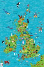
Children's Wall Map of the United Kingdom and Ireland
191 Kč -

Oxford Very First Atlas
196 Kč -

Usborne Illustrated Atlas of Britain and Ireland
410 Kč -
National Geographic Kids World Atlas
553 Kč -

Oxford Student Atlas 2012
436 Kč -
Maps Special Edition
1098 Kč -

Barefoot Books World Atlas
410 Kč -

Oxford International First Atlas Activity Book
198 Kč -
Children's Illustrated World Atlas
410 Kč -

National Geographic Kids Beginner's World Atlas, 3rd Edition
348 Kč -
C48 First Atlas Book
321 Kč -

Atlas of the World Picture Book
348 Kč -

Washington DC Children's Map
144 Kč -

Guy Fox Maps for Children
191 Kč -
First Animal Picture Atlas
356 Kč -
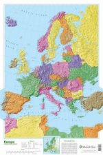
Map of Europe
606 Kč -

My Pop-up World Atlas
511 Kč -

Our World
389 Kč -
First Atlas
473 Kč -
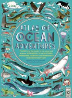
Atlas of Ocean Adventures
614 Kč -
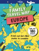
Lonely Planet Kids My Family Travel Map - Europe
530 Kč -

Oxford Primary Atlas
342 Kč -

Oxford First Atlas
312 Kč -
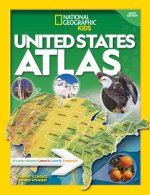
National Geographic Kids U.S. Atlas 2020
499 Kč -
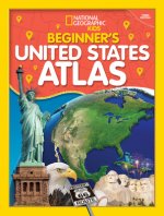
Beginner's U.S. Atlas 2020
403 Kč -
Collins Student Atlas
552 Kč -
Picture Atlas
191 Kč -

Lonely Planet Kids Amazing World Atlas
463 Kč -

Children's World Atlas
473 Kč -

Illustrated Atlas of India
600 Kč -

The Kingfisher Atlas of World History
675 Kč -

National Geographic Little Kids First Big Book of the World
851 Kč -

Usborne Internet-Linked First Atlas
354 Kč -

First Picture Atlas
318 Kč -
Mapping Skills
585 Kč -
Mapping Skills
585 Kč -
Children's Illustrated Atlas (Library Edition)
539 Kč -

Collins Keystart Junior Atlas CD-Rom
4255 Kč
Osobní odběr Praha, Brno a 12903 dalších
Copyright ©2008-24 nejlevnejsi-knihy.cz Všechna práva vyhrazenaSoukromíCookies


 Vrácení do měsíce
 571 999 099 (8-15.30h)