Kód: 01261849
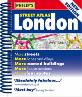
Philip's Street Atlas London
Autor Philip´s
A fully revised edition of this mini street atlas of inner London, which gives comprehensive and detailed coverage. The street maps of central London are at 7 inches to 1 mile, with the rest of inner London at the clear scale of 3 ... celý popis
- Jazyk:
 Angličtina
 - Vazba: Brožovaná
- ISBN-13: 9781849072083
Nakladatelství: PHIL, 2012
- Více informací o knize

Mohlo by se vám také líbit
-

Wolf of Wall Street
470 Kč -

Live Wire
276 Kč -

A Picture of Health
406 Kč -

Psí dominance: Mýtus, nebo skutečnost?
119 Kč -

O princeznách a vílach
223 Kč -

Der Feind im Schatten
335 Kč -

3000 Jahre Analysis
2204 Kč
Informovat o naskladnění knihy
Zadejte do formuláře e-mailovou adresu a jakmile knihu naskladníme, zašleme vám o tom zprávu. Pohlídáme vše za vás.
Více informací o knize Philip's Street Atlas London
 Anotace knihy
A fully revised edition of this mini street atlas of inner London, which gives comprehensive and detailed coverage. The street maps of central London are at 7 inches to 1 mile, with the rest of inner London at the clear scale of 3.5 inches to 1 mile. The maps mark every named street, lane, alley, court and walkway, plus car parks, tube, rail and bus stations, post offices, schools, colleges, hospitals, police and fire stations, places of worship, leisure centres, footpaths and bridleways, golf courses, and many other places of interest. The central London Olympic venues are clearly shown.A theatres and cinemas map of central London locates more than 50 theatres and cinemas, and there is also a map of the entire London Underground.The comprehensive index lists street names and postcodes, plus hundreds of places of interest. Schools, hospitals, railway stations and shopping centres, etc, are highlighted in red, while leisure and entertainment venues such as museums, galleries and sports grounds are shown in blue.Philip's Street Atlas London is suitable for both drivers and pedestrians. For drivers, route-finding in London is much easier as through-routes are highlighted, giving the user the equivalent of local knowledge of an area. Speed cameras, one-way streets and restricted turns are clearly displayed with the Congestion Charge Zone. For pedestrians, tourist sights and attractions are clearly labelled, public transport systems are featured, and its compact size fits easily into a briefcase or handbag. The clear layout and mini size are ideal for cyclists too.
 Parametry knihy
Zařazení knihy Knihy v angličtině Lifestyle, sport & leisure Travel & holiday Travel maps & atlases
- Plný název: Philip's Street Atlas London
- Autor: Philip´s
- Jazyk:
 Angličtina
 - Vazba: Brožovaná
- EAN: 9781849072083
- ISBN: 1849072086
- ID: 01261849
- Nakladatelství: PHIL
- Hmotnost: 224 g
- Rozměry: 124 × 142 × 24 mm
- Datum vydání: 07. May 2012
Oblíbené z jiného soudku
-
Österreich, Autoatlas 1:150.000, freytag & berndt
540 Kč -

Burgenland, Straßen- und Freizeitkarte 1:150.000, freytag & berndt
265 Kč -
Lonely Planet Scotland Planning Map
176 Kč -

Lonely Planet Africa Planning Map
143 Kč -

Azores, Special Places of Excursion Road Map 1:50 000
332 Kč -

Camino de Santiago: Camino Frances
462 Kč -

Deutschland, Autoatlas 1:200.000, 2024/2025, freytag & berndt
342 Kč -

Albanien, Straßen- und Freizeitkarte 1:150.000, freytag & berndt
332 Kč -

Tokyo- Michelin City Map Laminated 9219
313 Kč -

Evia
225 Kč -

Gibraltar
518 Kč -

Lonely Planet Sydney City Map
143 Kč -

Lonely Planet Washington DC City Map
214 Kč -

Malt Whisky Map of Scotland
223 Kč -
Transit Maps of the World
734 Kč -

Israel
426 Kč -

Annapurna, Nepal
426 Kč -

Lanzarote Marco Polo Holiday Map
170 Kč -

Uzbekistan
359 Kč -

New York - Michelin City Map 9204
264 Kč -
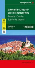
Slowenien - Kroatien - Bosnien-Herzegowina, Straßenkarte 1:500.000, freytag & berndt
264 Kč -

Neuer Straßenatlas Deutschland/Europa 2024/2025
179 Kč -

Namibia
381 Kč -

Ben Nevis and Fort William, the Mamores and the Grey Corries, Kinlochleven and Spean Bridge
343 Kč -

Vienna City Atlas 1:12,500 scale
318 Kč -

Cinque Terre - Portofino Hiking + Leisure Map 1:50 000
299 Kč -

Italien Nord, Straßenkarte 1:500.000, freytag & berndt
332 Kč -
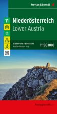
Niederösterreich, Straßen- und Freizeitkarte 1:150.000, freytag & berndt
286 Kč -

Carte de randonnées Alpes Vanoise. Hiking Map Alps Vanoise
374 Kč -

Glen Coe
343 Kč -

Loch Lomond North, Tyndrum, Crianlarich & Arrochar
343 Kč -

Ardnamurchan, Moidart, Sunart and Loch Shiel
343 Kč -

ADFC-Regionalkarte Bodensee, 1:50.000, reiß- und wetterfest, mit kostenlosem GPS-Download der Touren via BVA-website oder Karten-App
285 Kč -
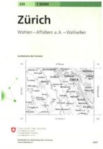
Zurich
371 Kč -
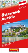
Österreich Strassenkarte 1:500 000
326 Kč -

Hong Kong & Macau Travel Map Sixth Edition
233 Kč -
Karpathos Kasos
212 Kč -

Pocket Atlas of Remote Islands
629 Kč -

Morocco - Michelin National Map 742
381 Kč -

Lonely Planet Europe Planning Map
221 Kč -

Peru
325 Kč -
Lonely Planet London City Map
257 Kč -

Lonely Planet Tokyo City Map
214 Kč -

Lonely Planet South America Planning Map
143 Kč -

Vintage Maps Kalender 2024 - 30x30
140 Kč -

Mountaineering in the Swiss Alps
452 Kč -

Biker Atlas EUROPA 2024
382 Kč -
West Highland Way Map Booklet
301 Kč -

Tenerife Hikers Maps
303 Kč
Osobní odběr Praha, Brno a 12903 dalších
Copyright ©2008-24 nejlevnejsi-knihy.cz Všechna práva vyhrazenaSoukromíCookies


 Vrácení do měsíce
 571 999 099 (8-15.30h)